Day Fourteen - La Fin

Being the last day of my ride, and given that I had to get to the bike shop with which I’d coordinated to have my bike boxed & supper, and considering that I still had yet to find lodging for the night, and feeling well-rested and raring to go after a day of enforced rest, I got up and on the road early. “Morning begins at night” was my motto, and I’d packed and loaded all my bags onto my bike the night before. I still had a little chicken pot pie left over from my grocery run a few days ago, and I discovered that a little chicken pot pie is actually a pretty good breakfast before riding 55 miles on a cold morning into a headwind. I’d managed to miss the headwinds along the shore until today - probably because of the shift in weather patterns from the storm. But things were returning to normal, which meant a steady breeze from the Southwest. I noticed it as soon as I woke up, actually - the flag at the Maritime Museum across the road had already begun flying in the opposite direction from yesterday.

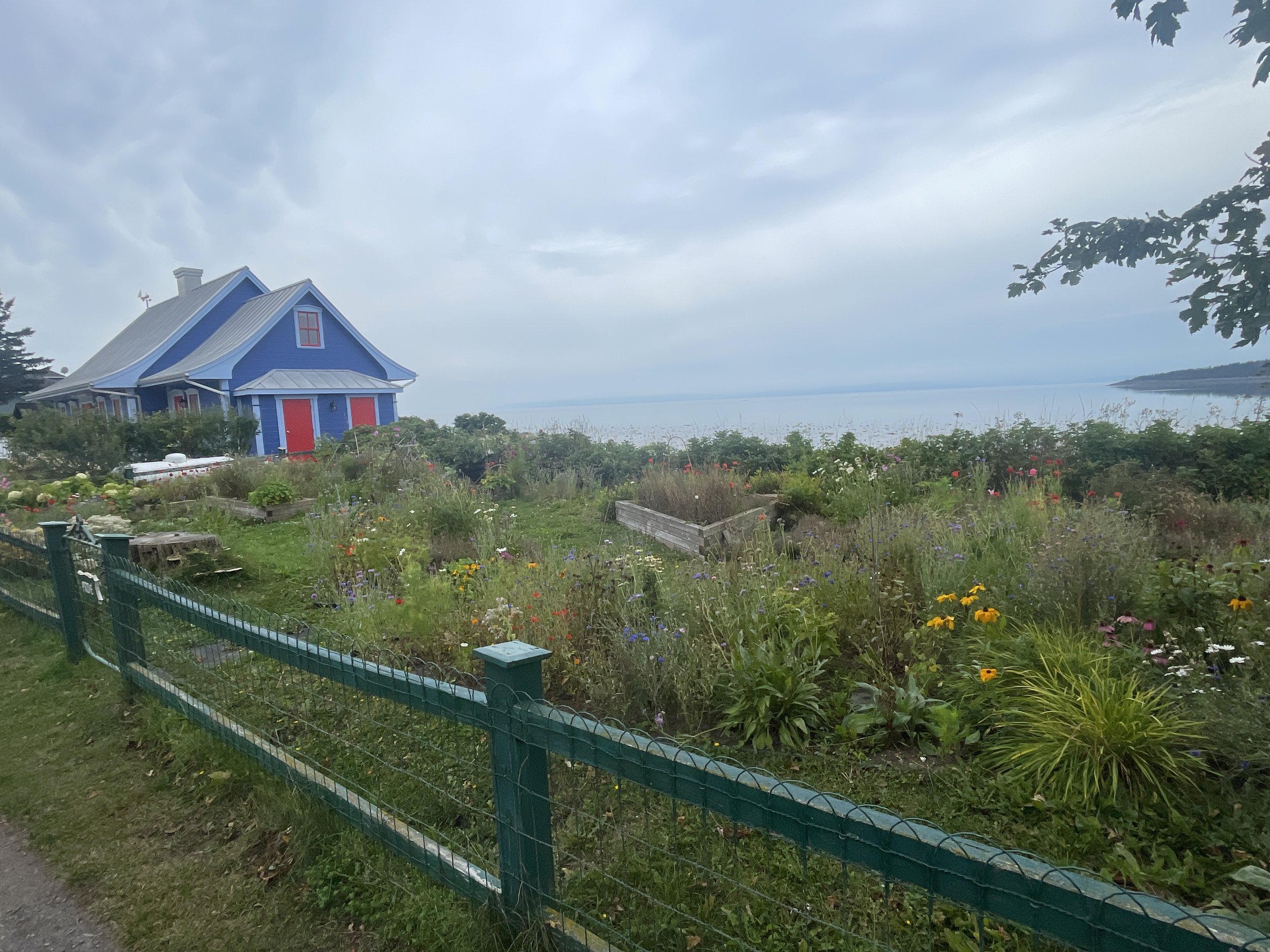
Off I rolled, out of L’Islet-Sur-Mer before most of its residents had finished their déjuner, and into a dry, if cloudy, morning. The winds started slow and then gradually increased as the morning wore on, and of course it varied based on tree cover, proximity to the seaway, and the road itself. The route I’d chosen had me winding often through little residential areas along the shore, so I was often able to avoid the wind by avoiding the main, open road. And it was a safer and more interesting route anyway. “Who are you people?” I often asked myself when riding past houses with big gardens or their own dock or, in one surprising instance, a series of miniature models of restored, historical buildings (maybe in the neighborhood) lining the walkway up the the front door. It was like walking through a slightly larger, Lionel train set display - only minus the trains. Retired? A modeling enthusiast? A real estate broker? Who knows…

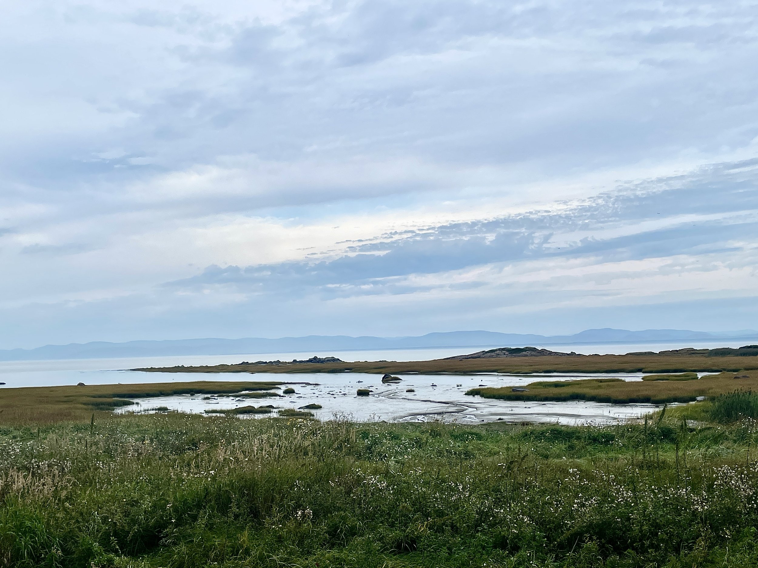
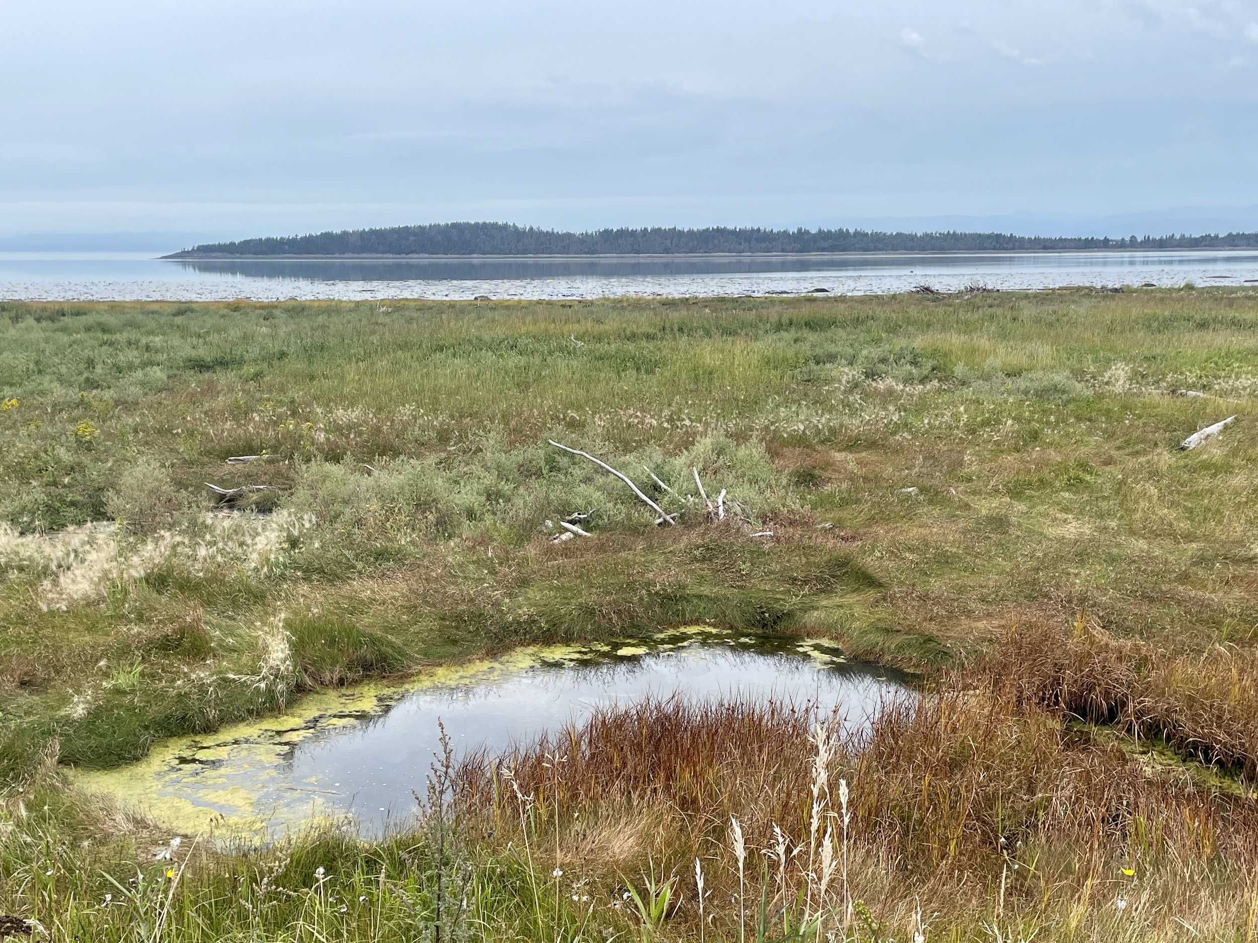
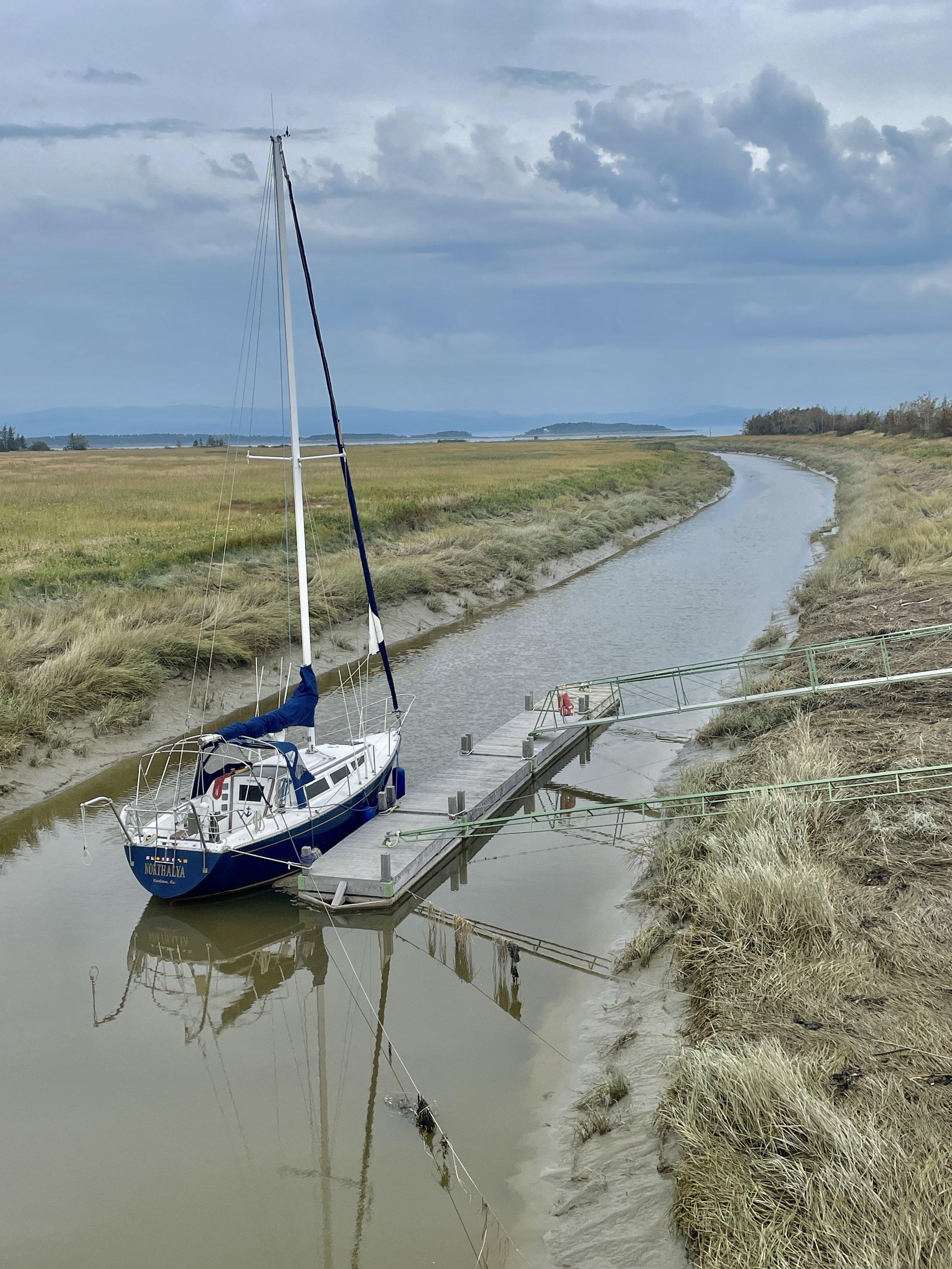
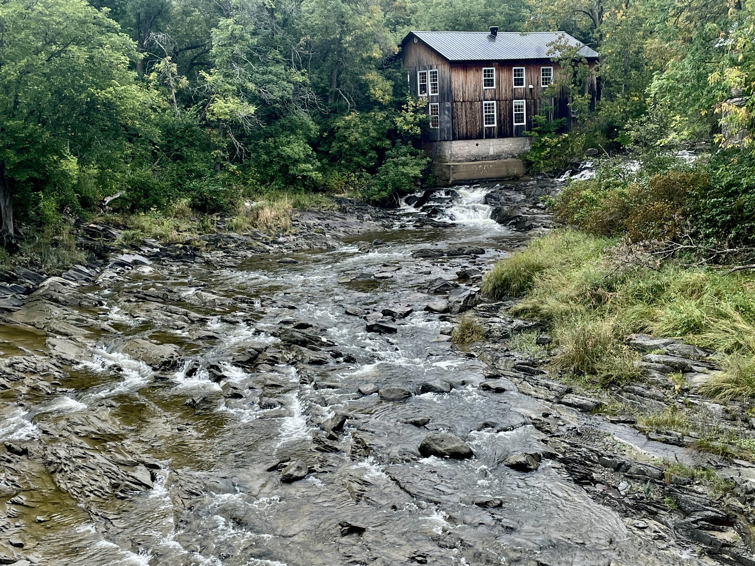
The occasional inlets from the seaway (or out to the seaway) got wider and, at one point in Montmagny, opened up into a wide falls whose turgid waters frothed and churned below. The quickened and chopped water flow reminded me of the run-up to Niagara Falls on last year’s ride, though naturally with a far more modest climax.

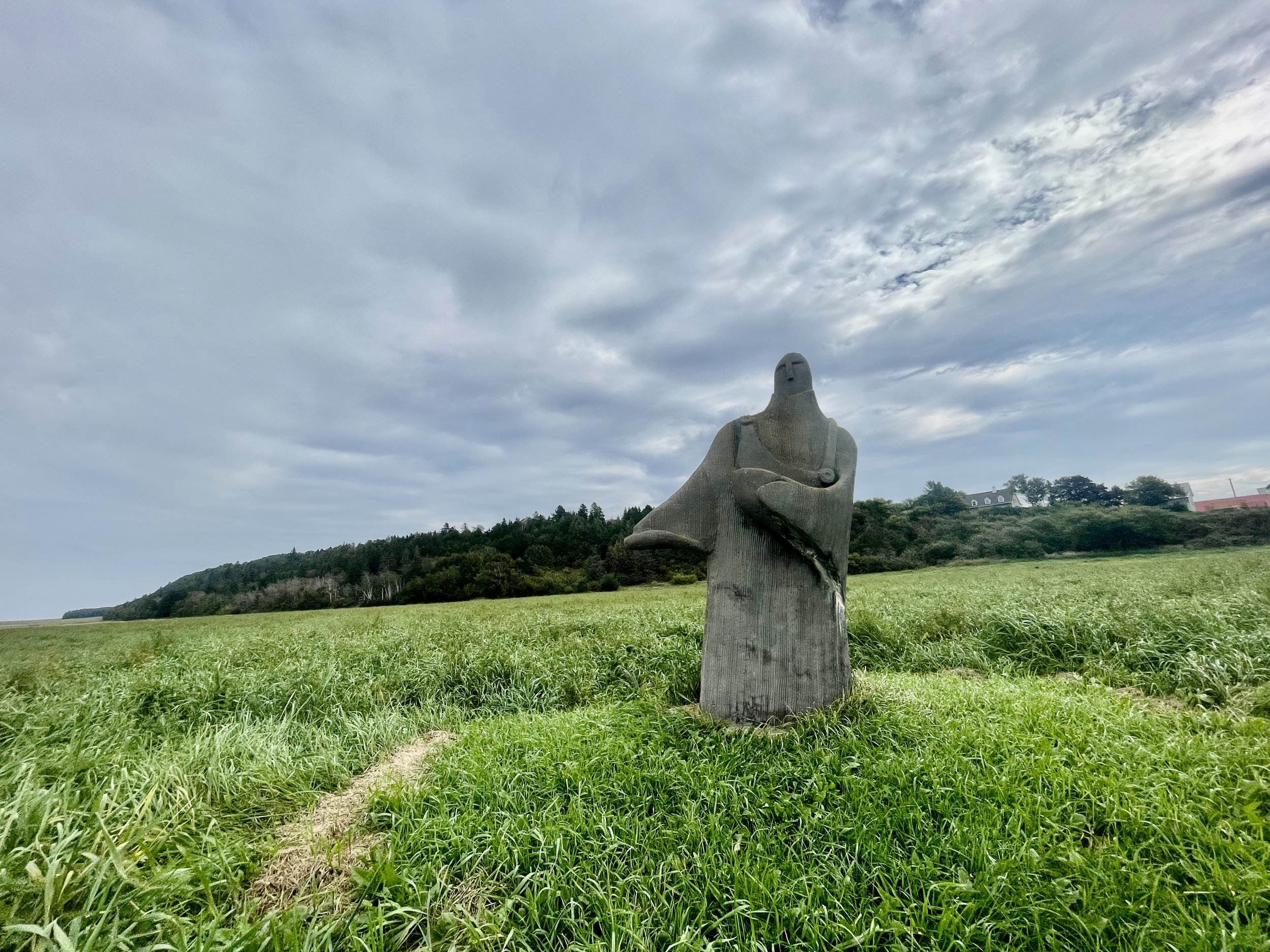
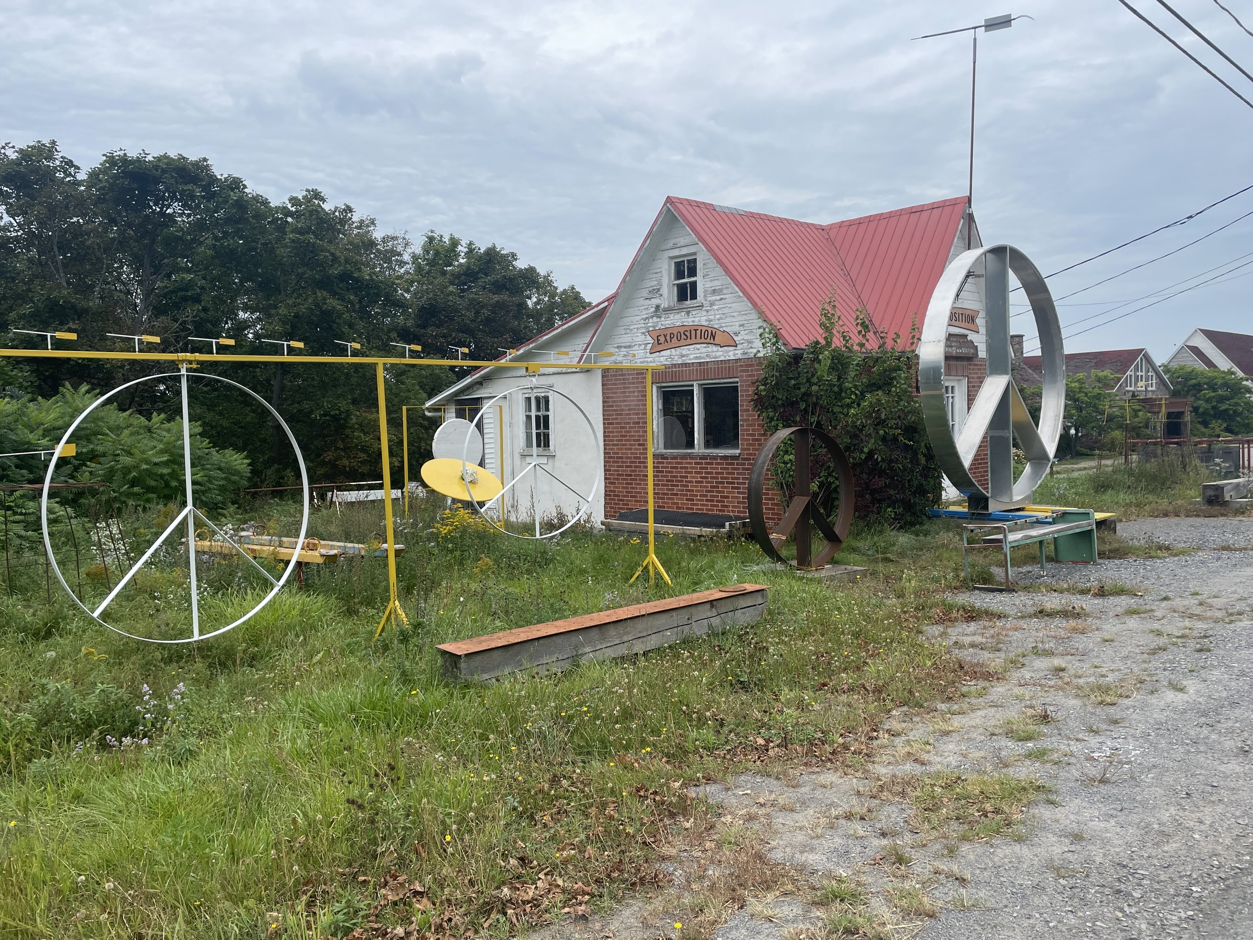
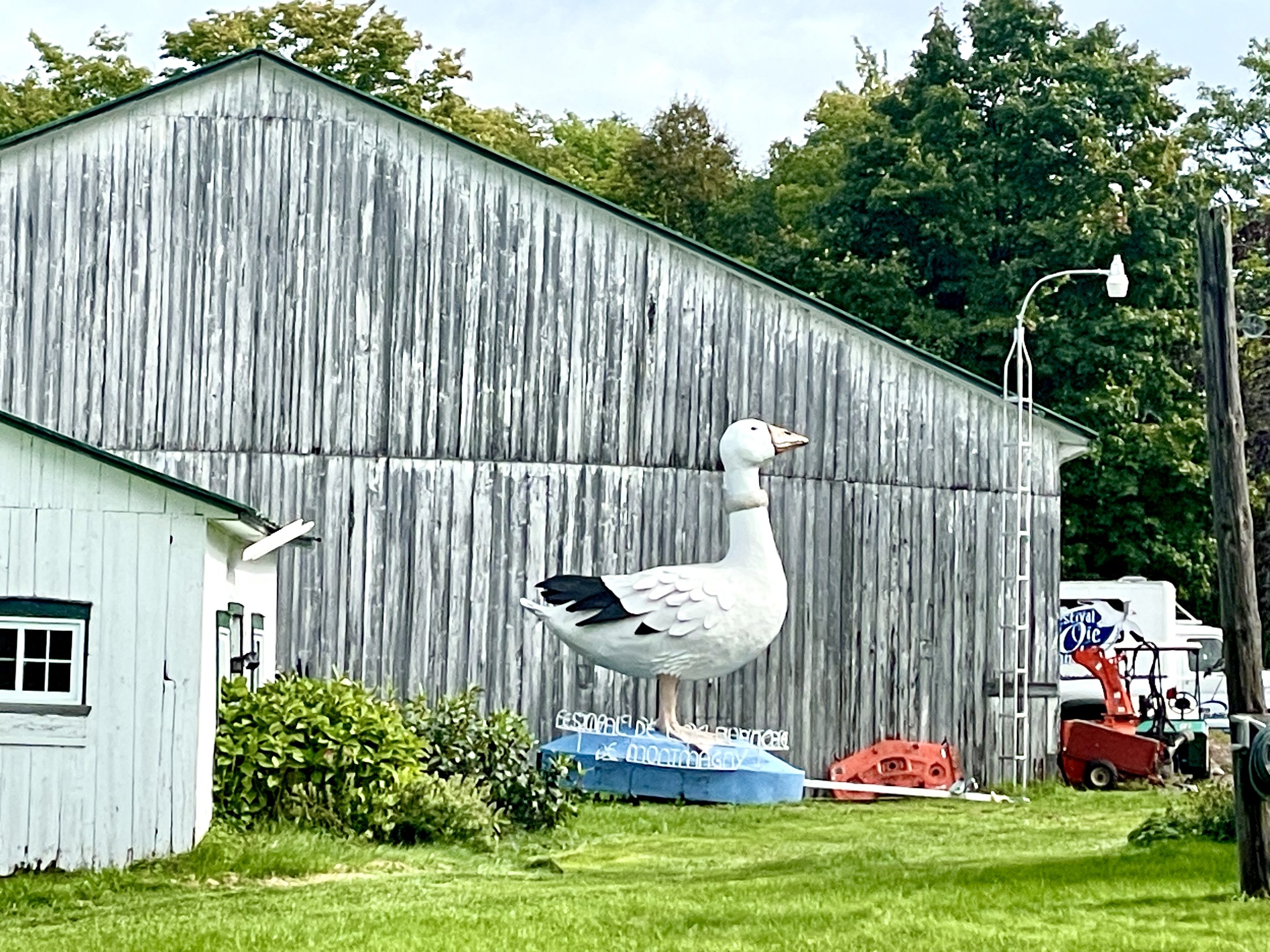
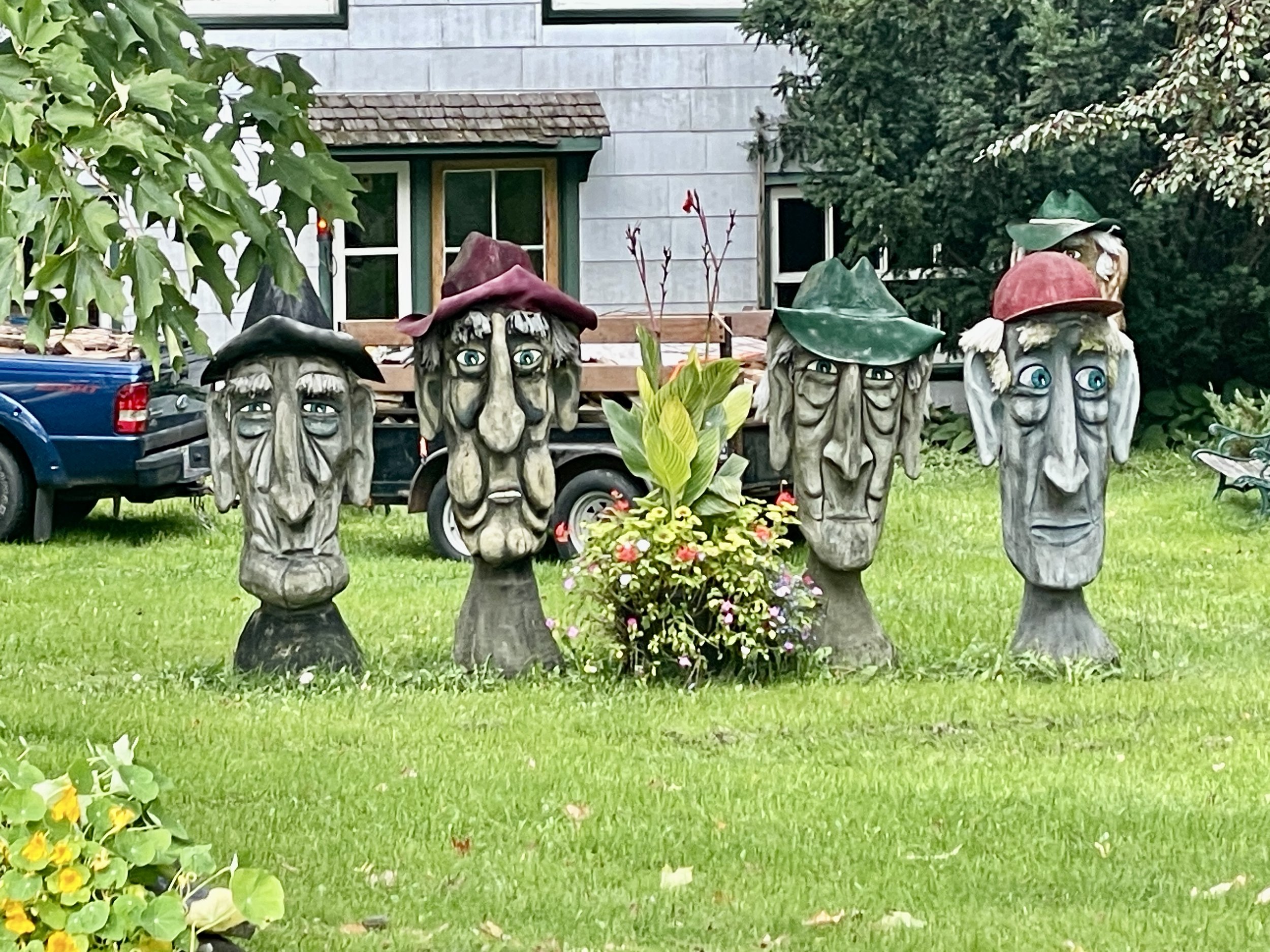
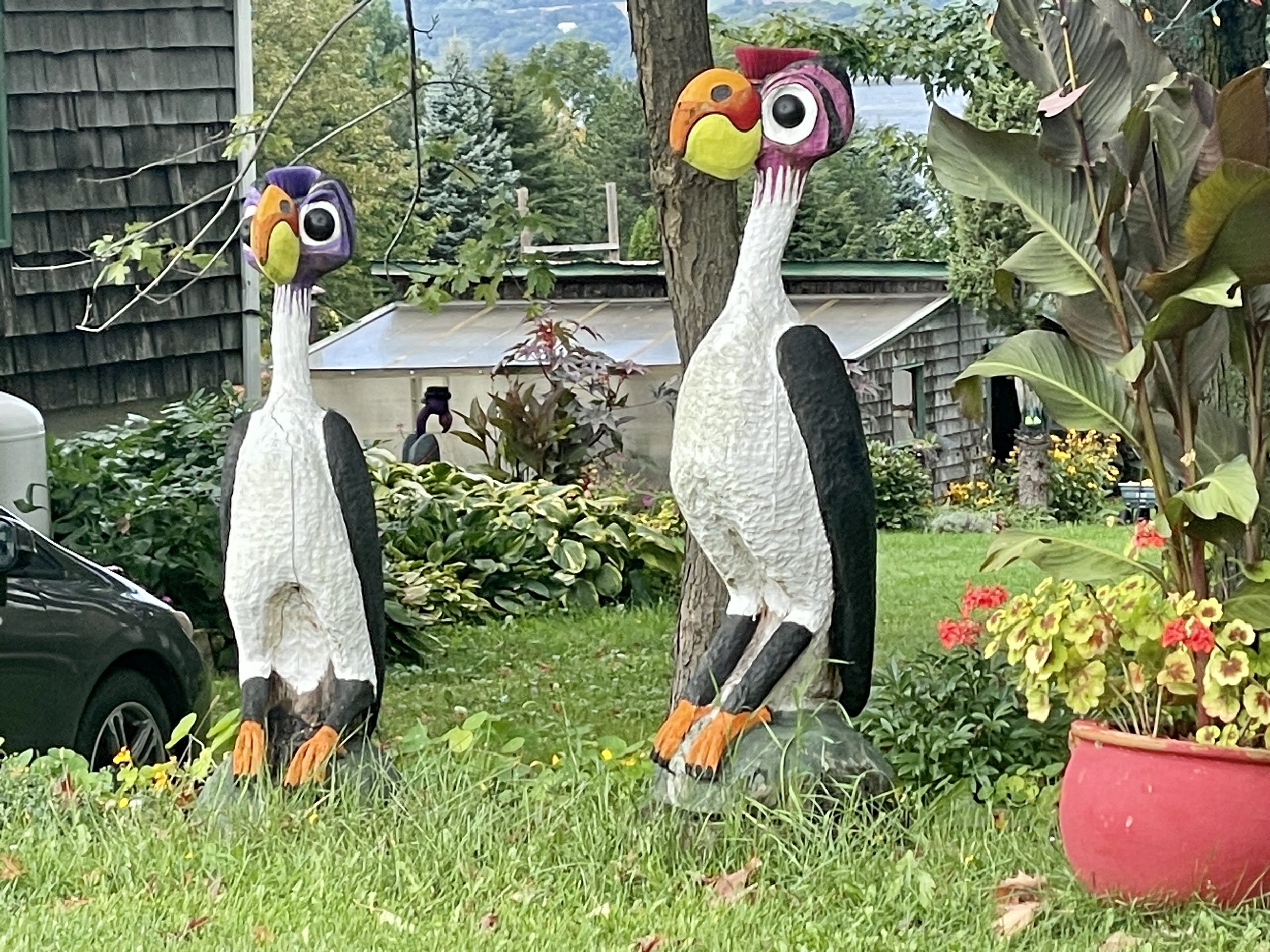
Again, with the roadside art.

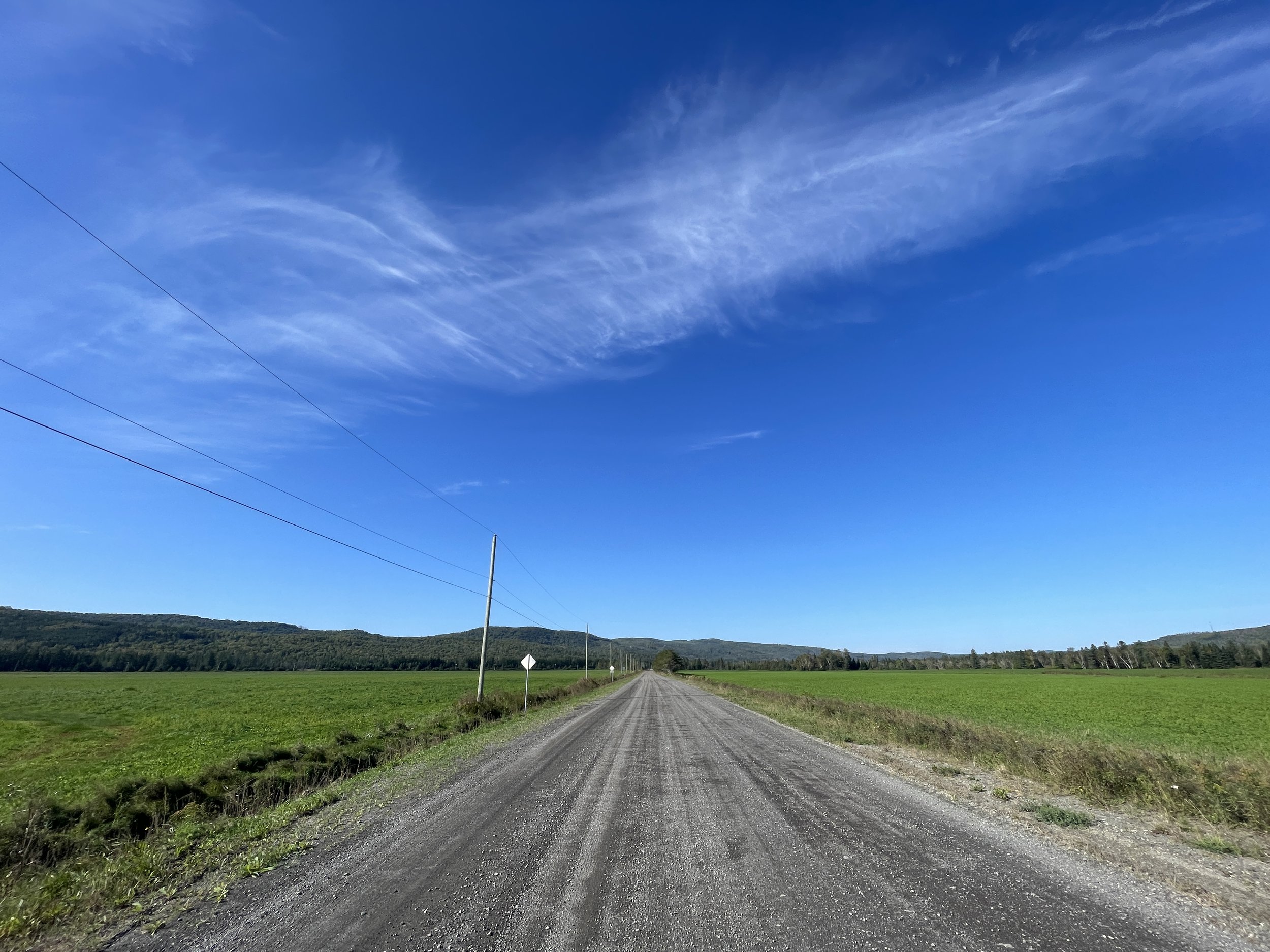
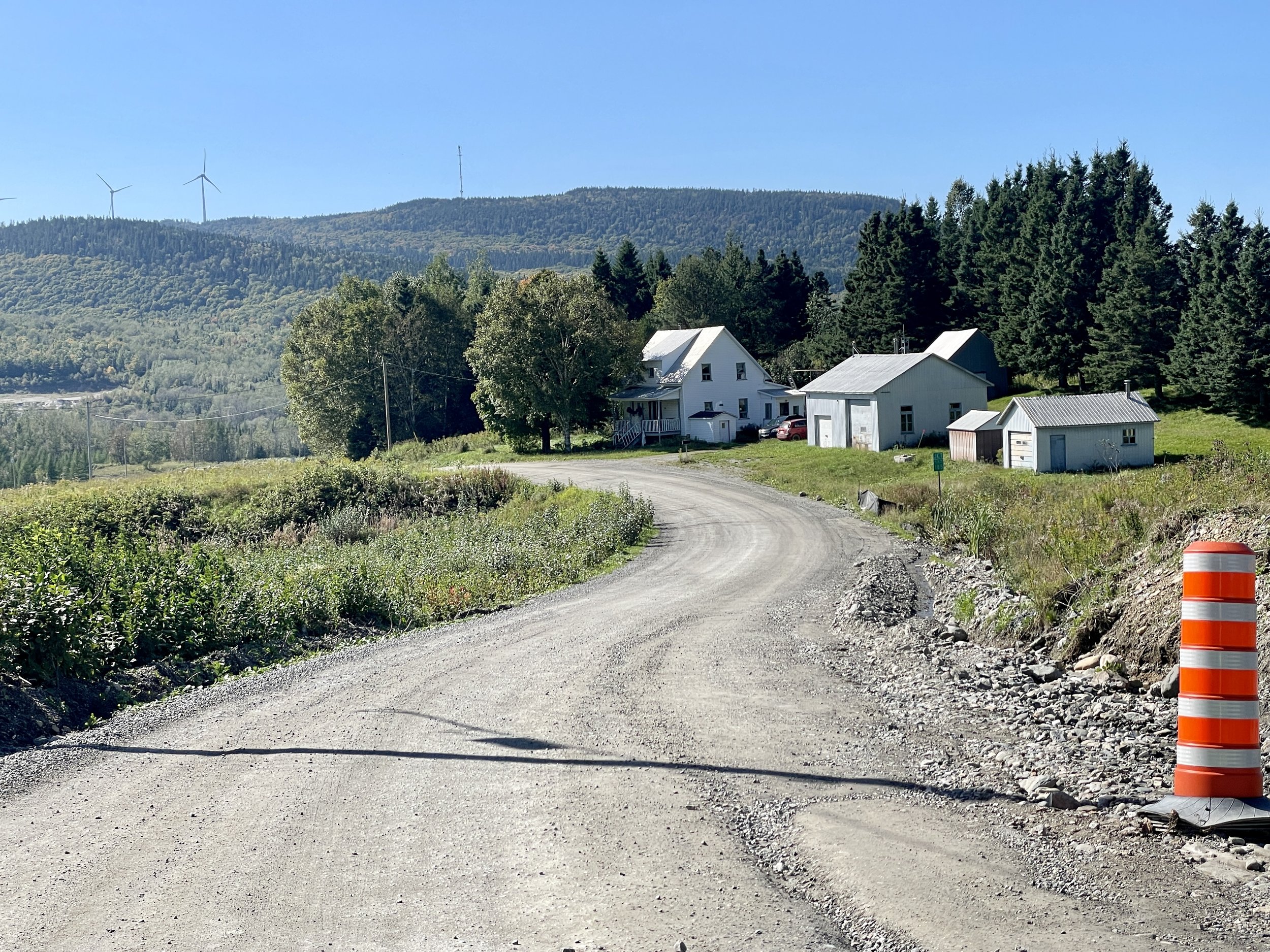
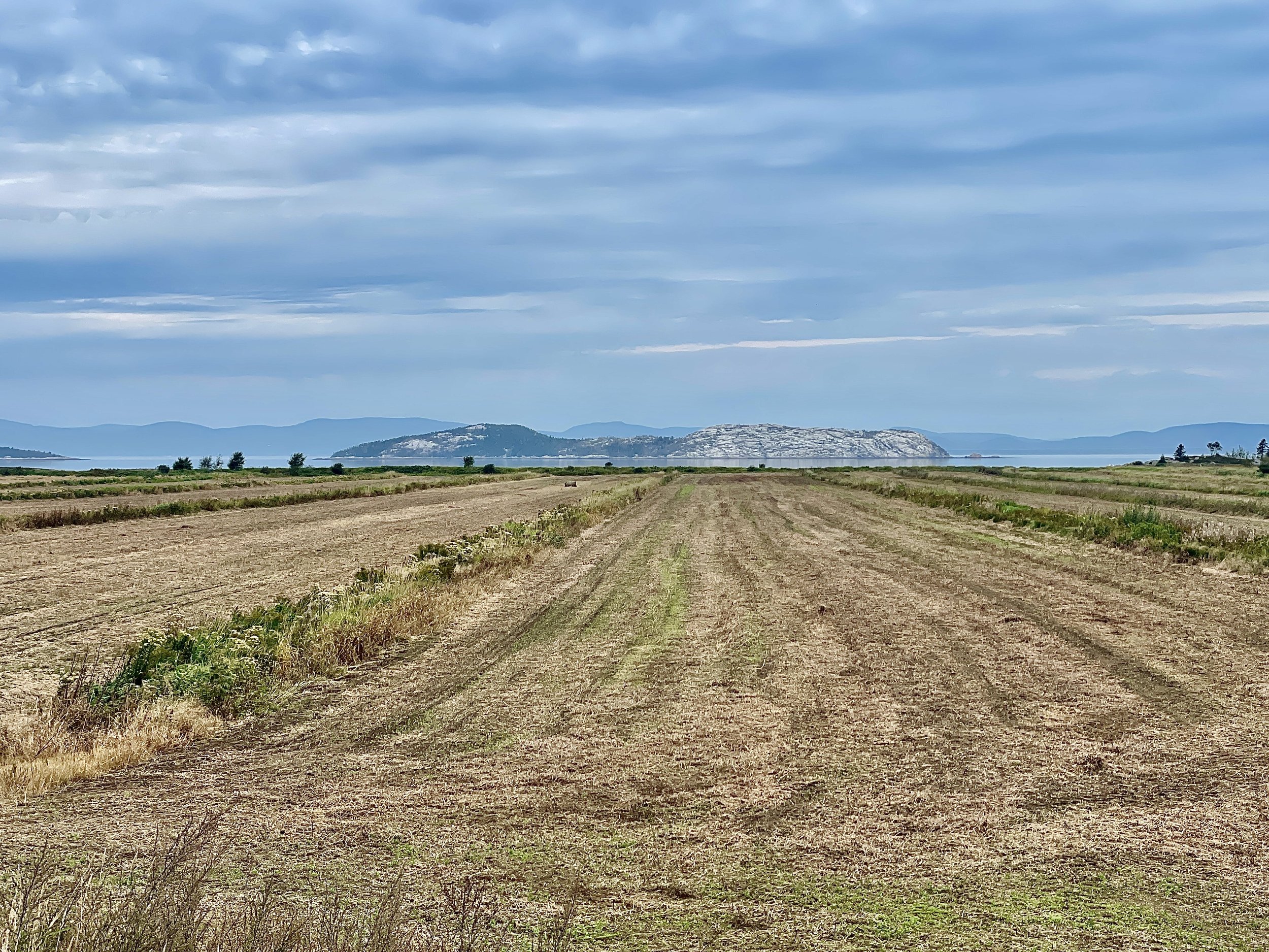
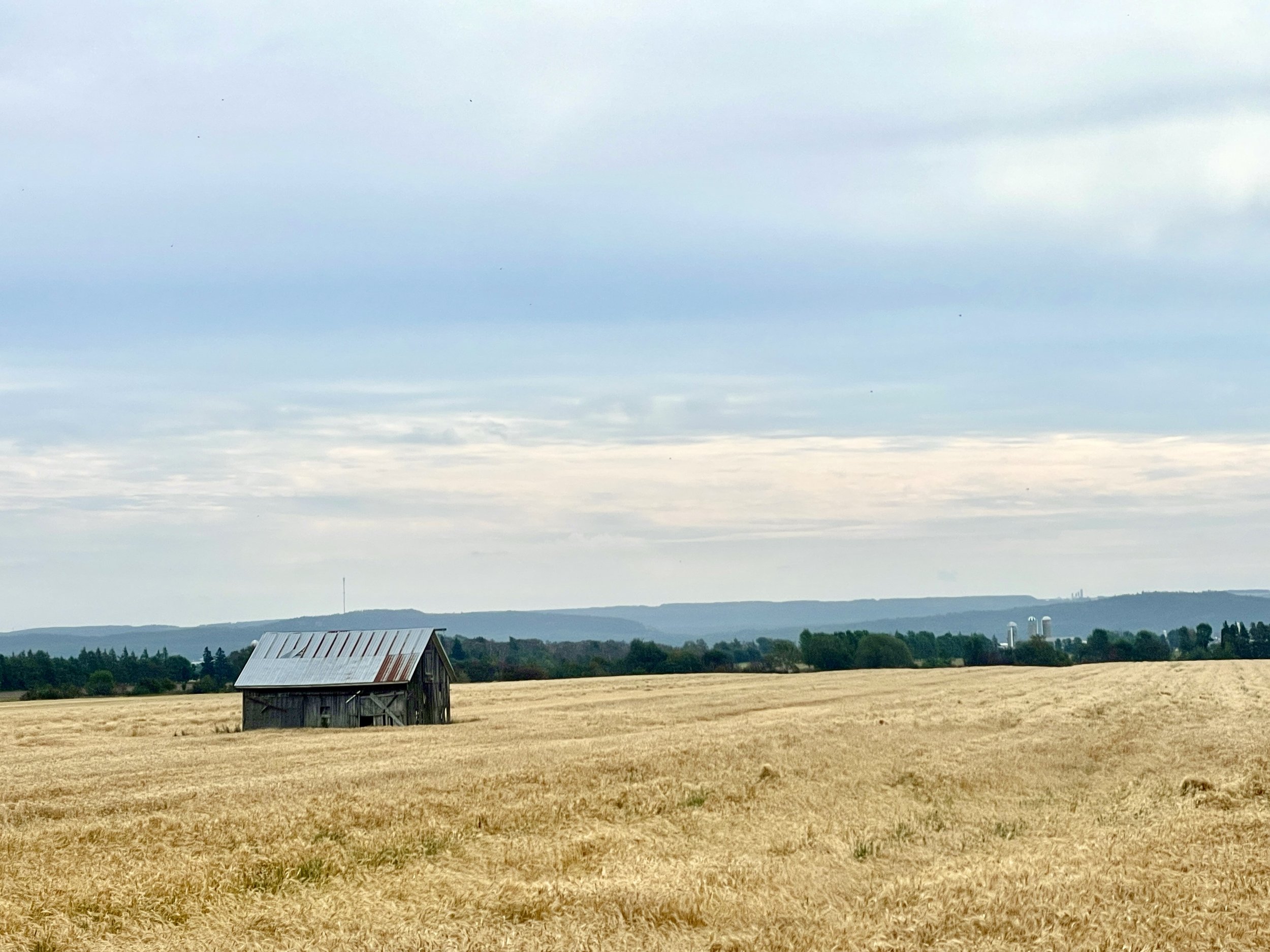
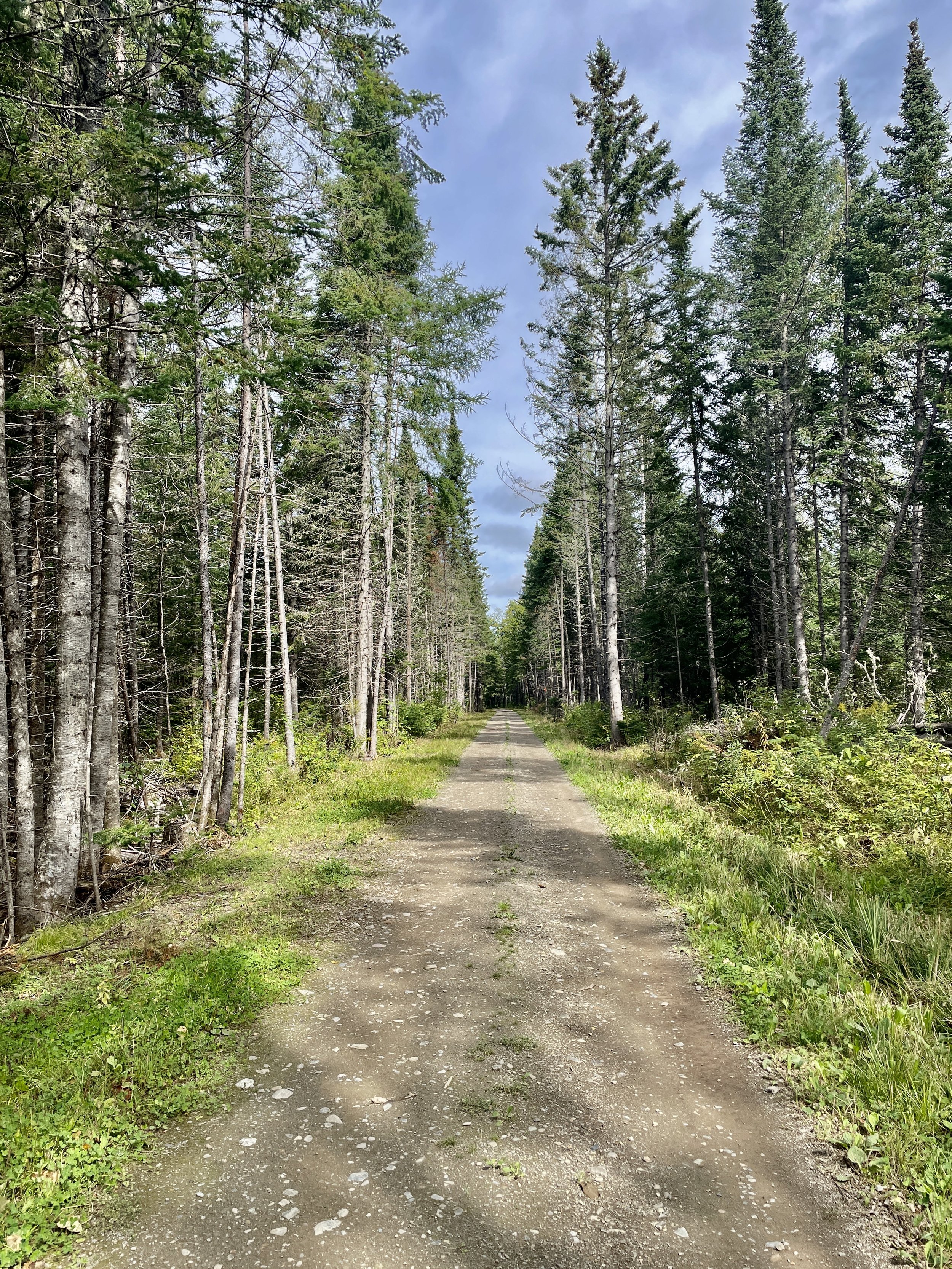
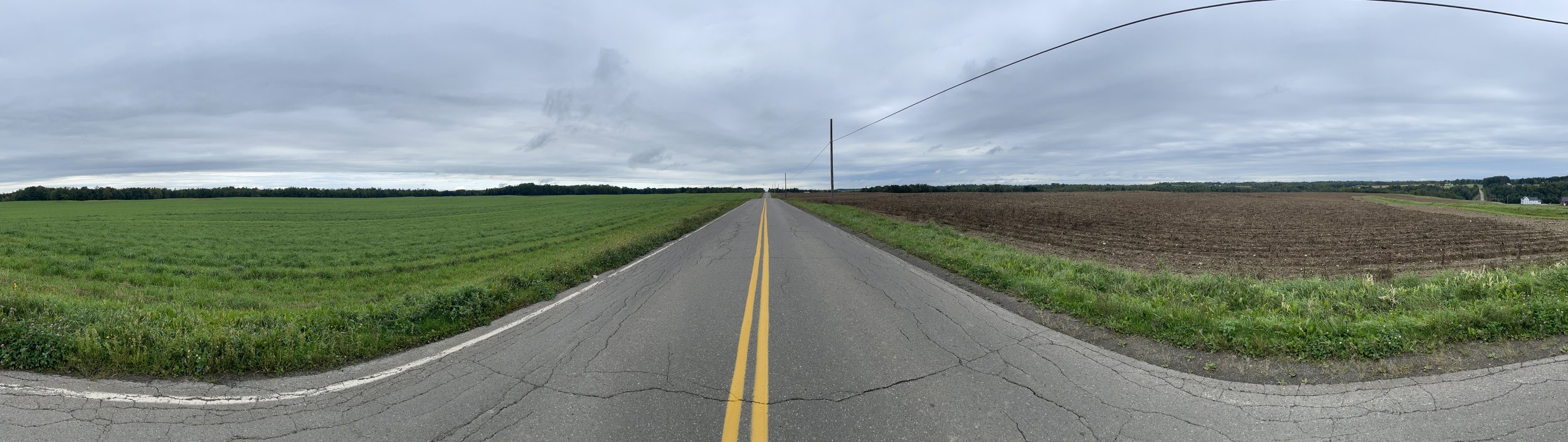
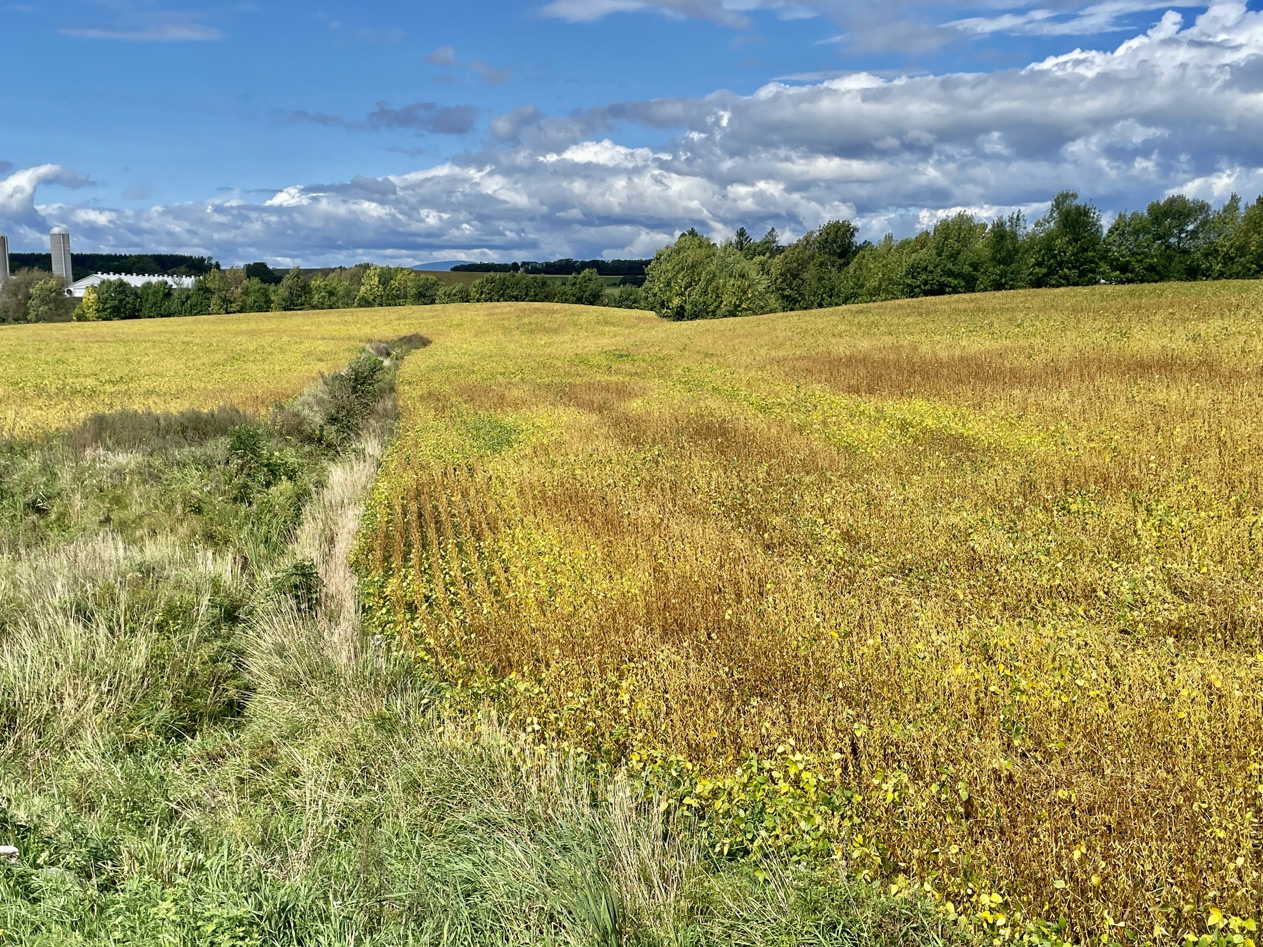
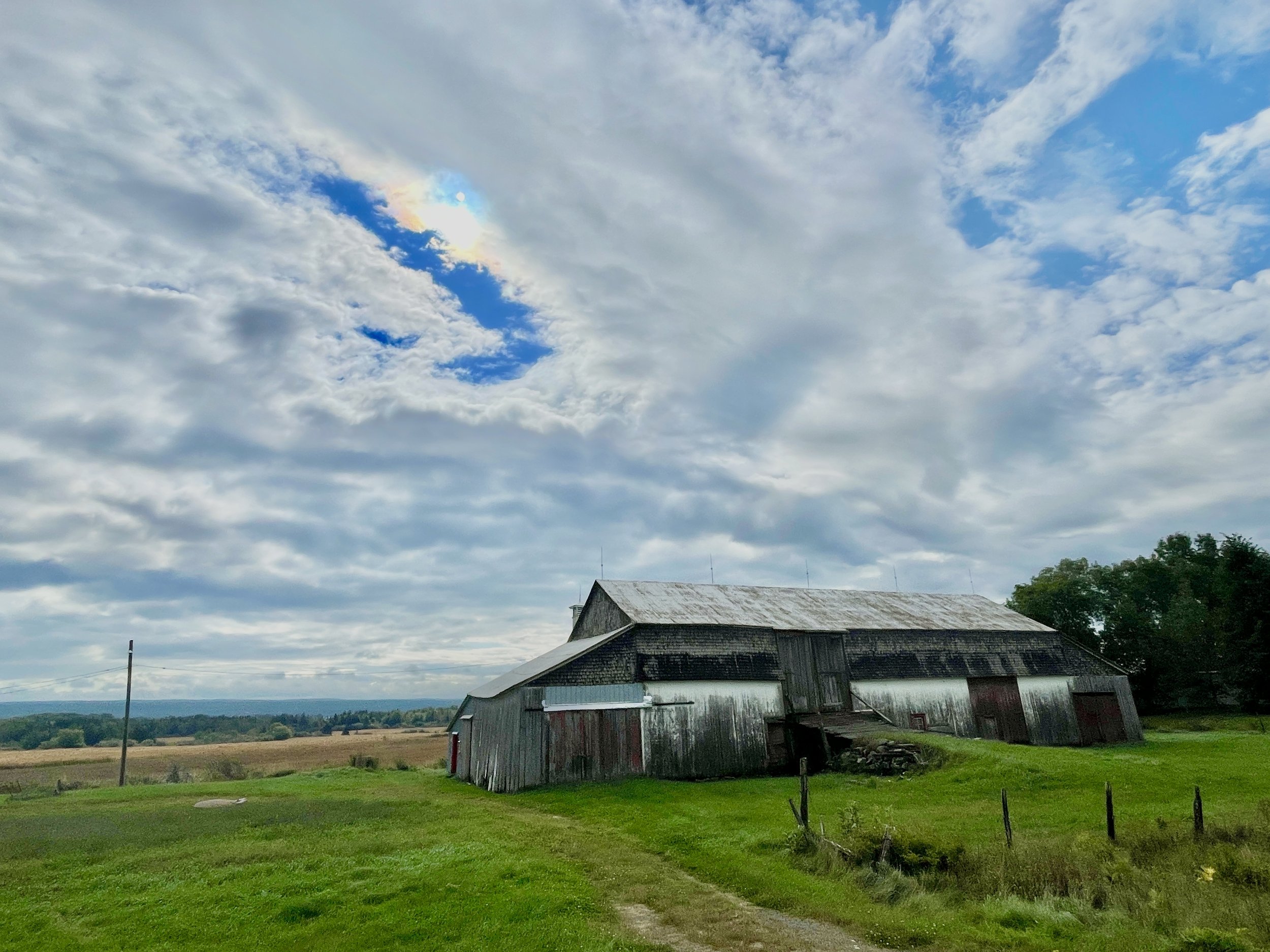
Again, with the wide farmlands.

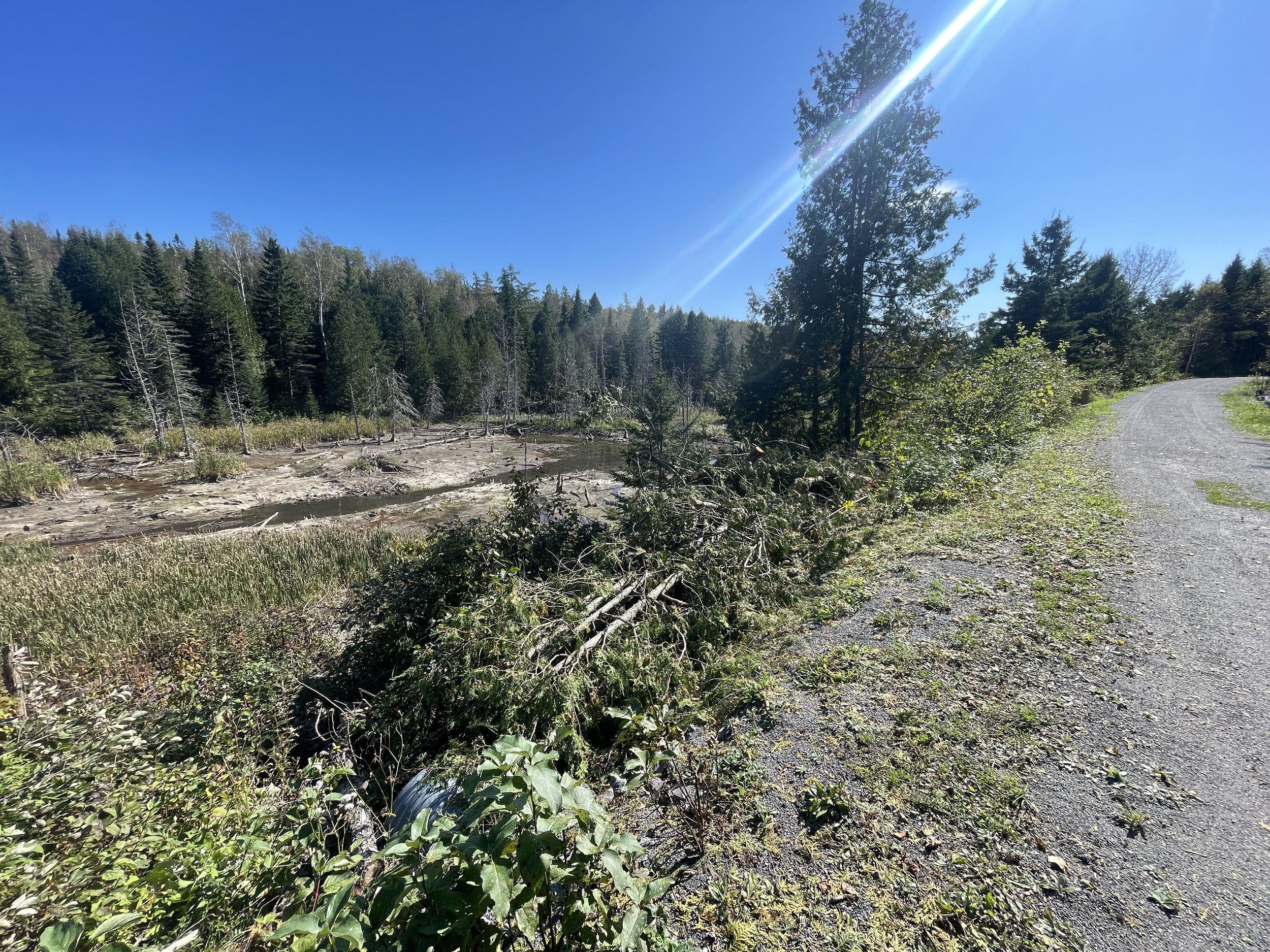
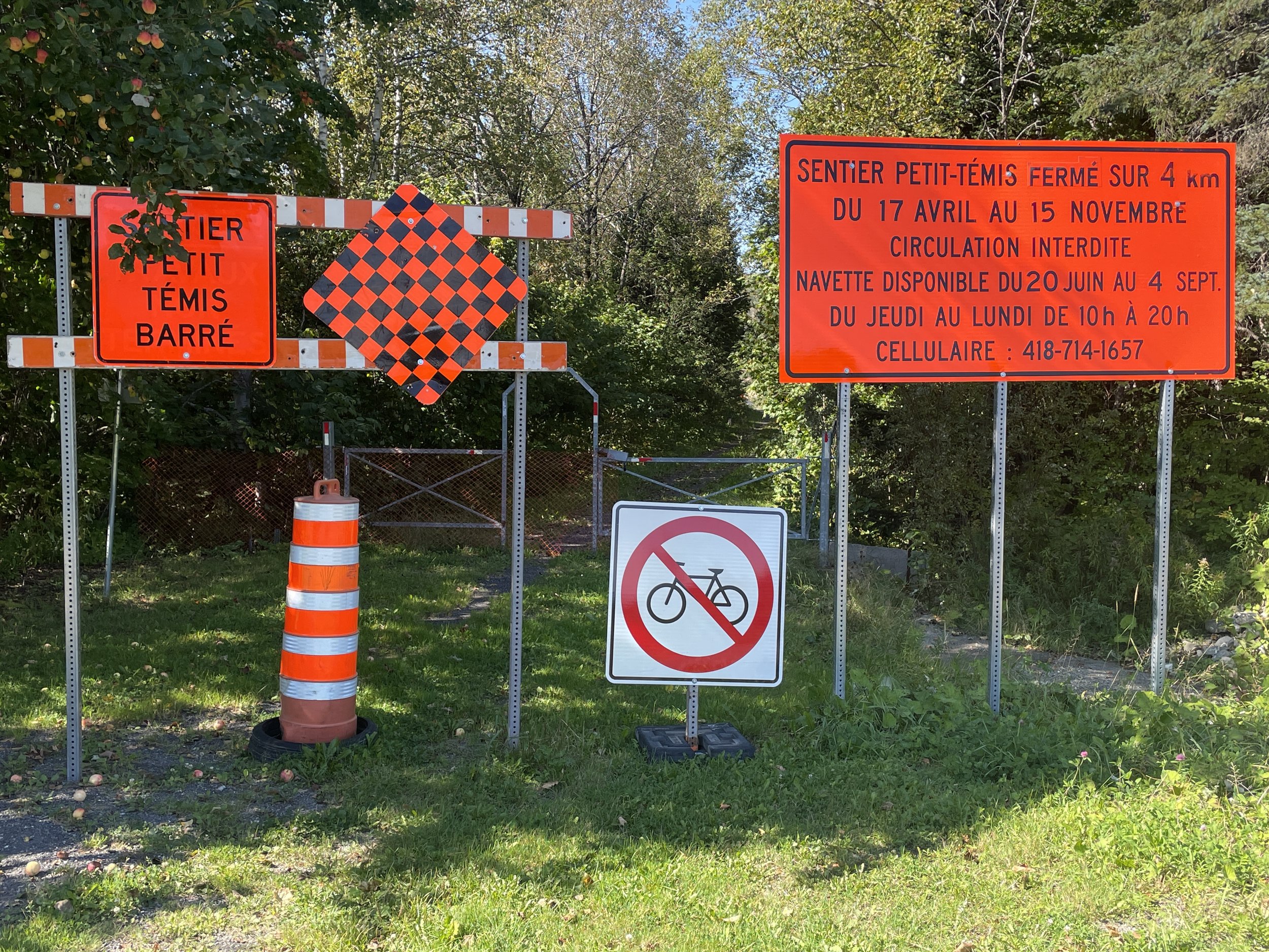
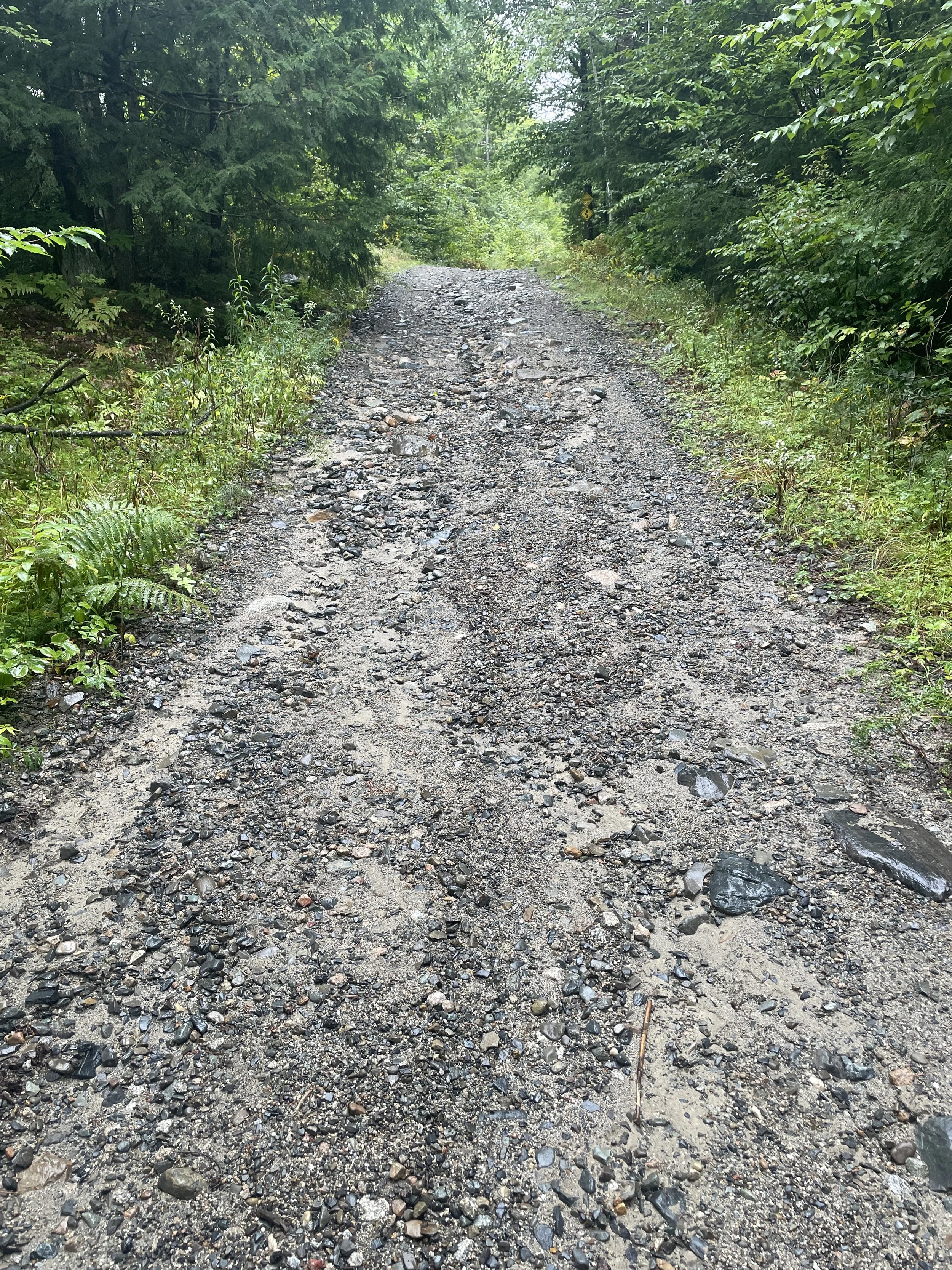
And again, with the trail closures.

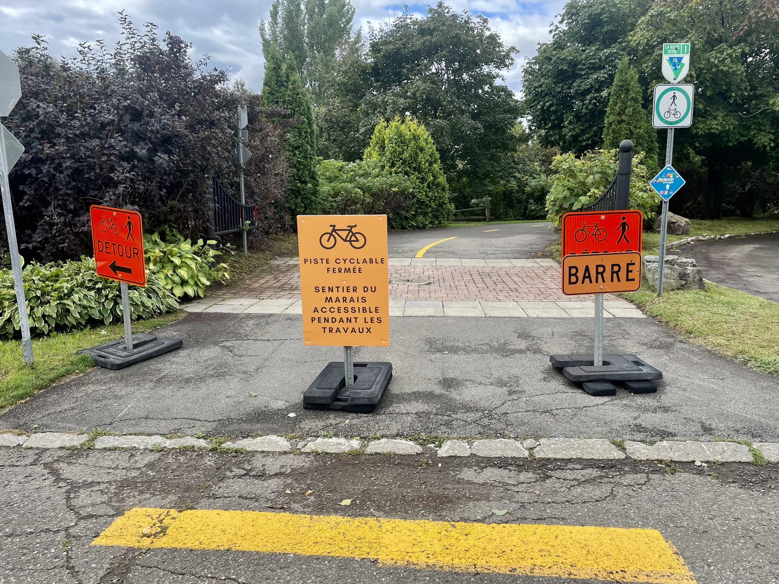
La Route Verte would seem to be in need of, or on the way to, a lot of construction at the moment. Fortunately, there were a lot more options for detours than back up on the Martian landscape I’d crossed a couple days before.

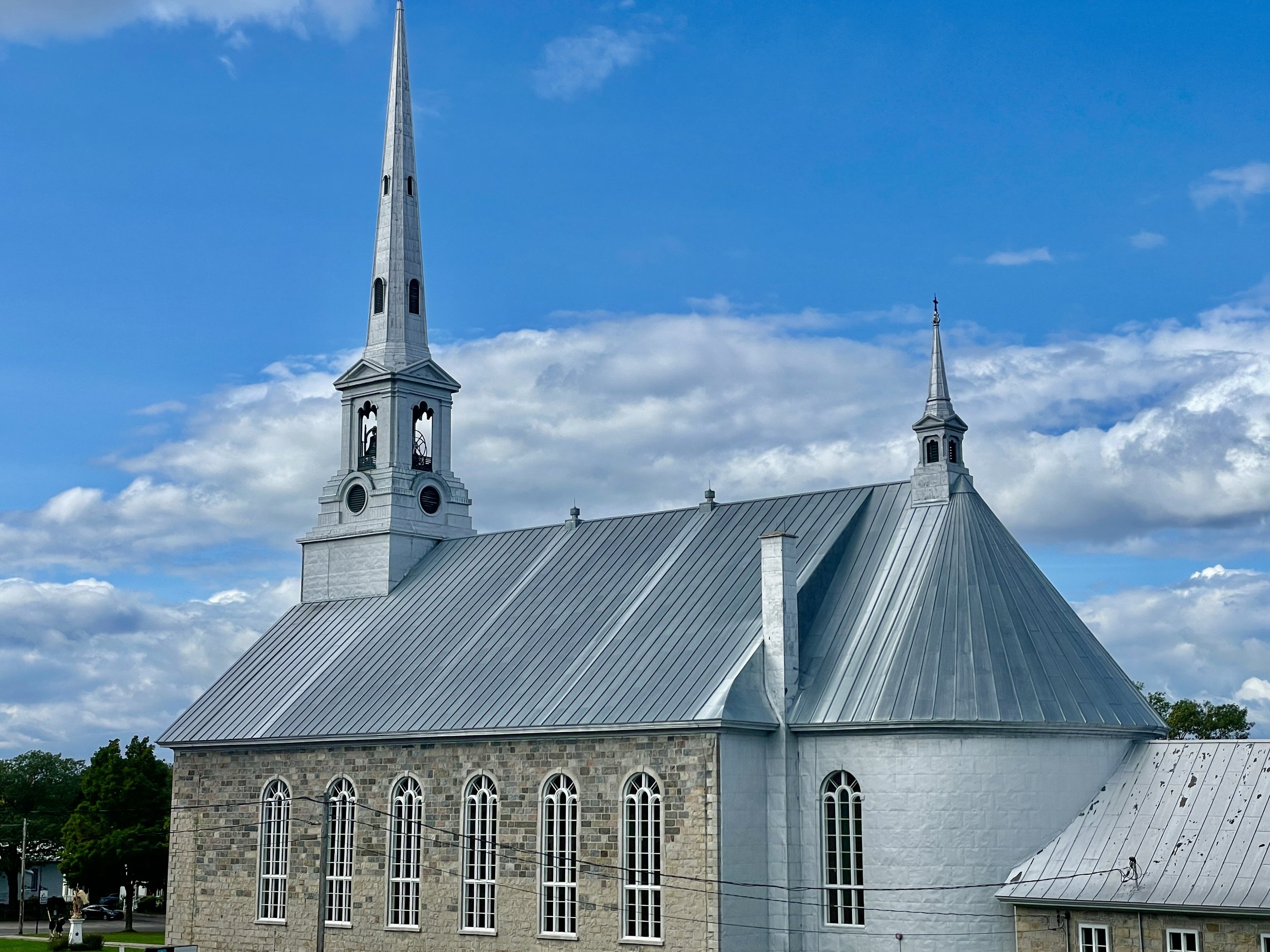
And again, with the silver-topped churches. I don’t know if it’s an aesthetic choice or for another more practical reason, but all the larger or mid-sized churches along the seaway have the same, silver roofing. It may have something to do with snowfall or heat management, but it’s a surprisingly anondized (and thus modern) feel to what are otherwise charming, roadside churches. As if Boeing’s getting into religious architecture. 

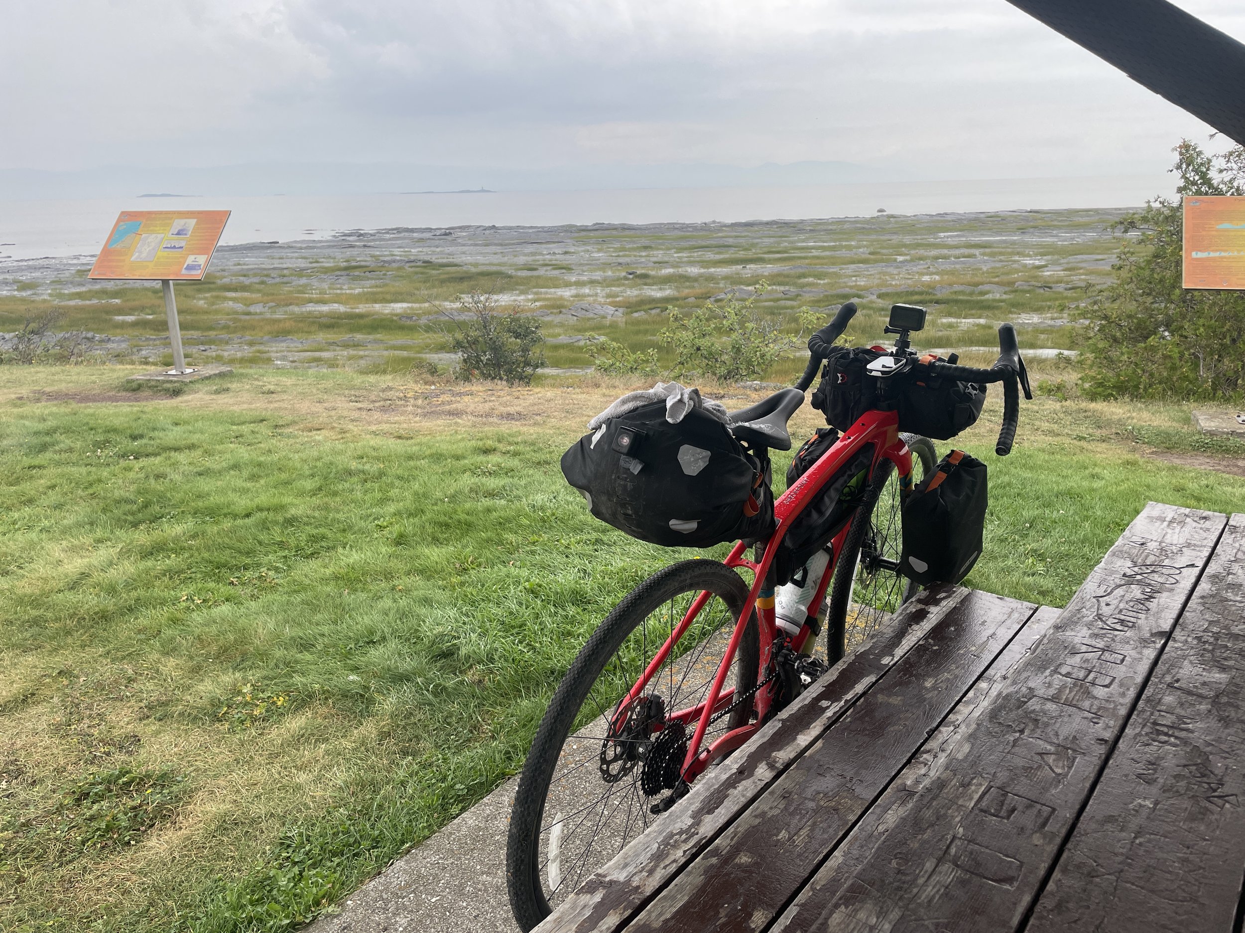
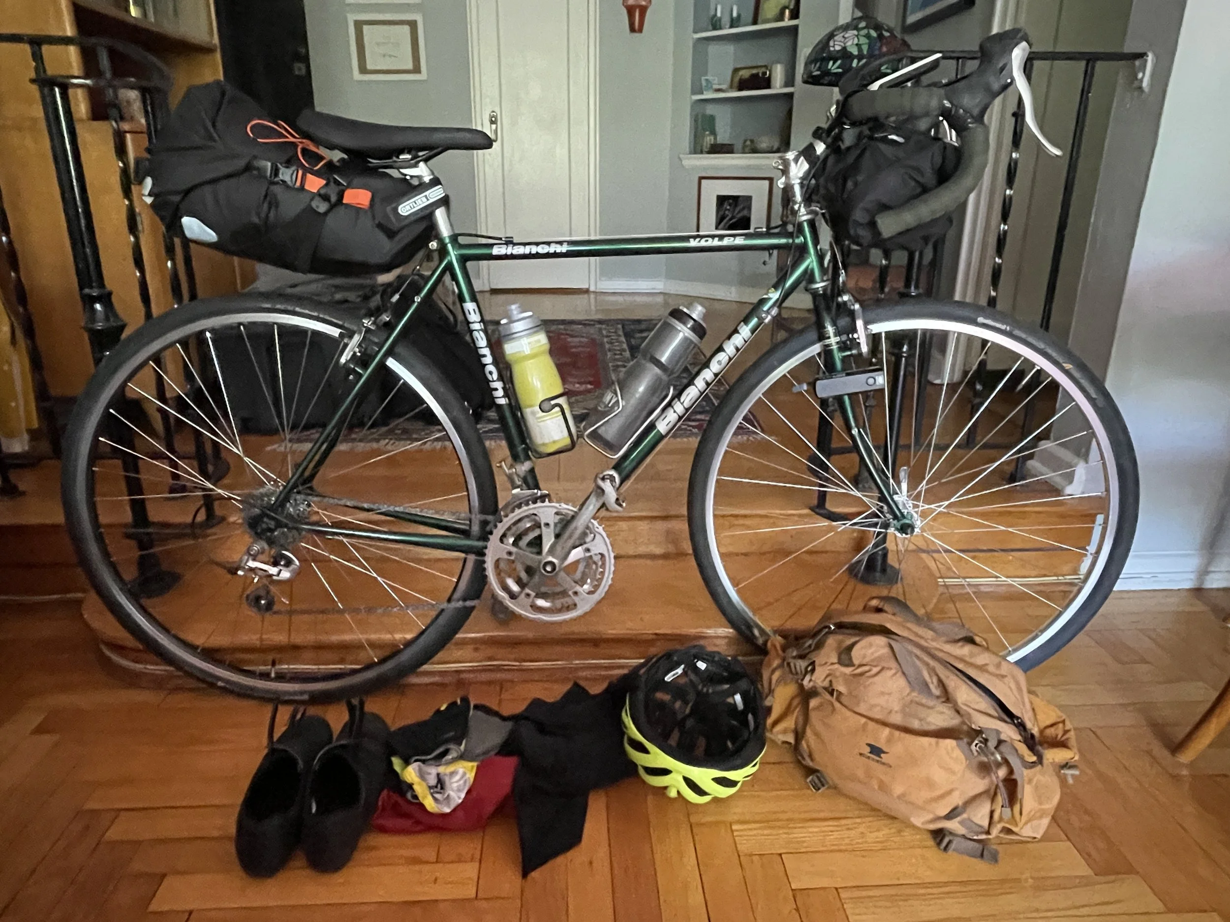
The wind was the wind. I knew it would be there, and I was glad it wasn’t worse. I’d had worse on this ride, and I didn’t care to revisit it. I took the opportunity to move into the drops on my handlebars and practice my aerodynamic stance. It might have been more helpful if I wasn’t also carrying front fork bags, but it helped, particularly on the downhills.

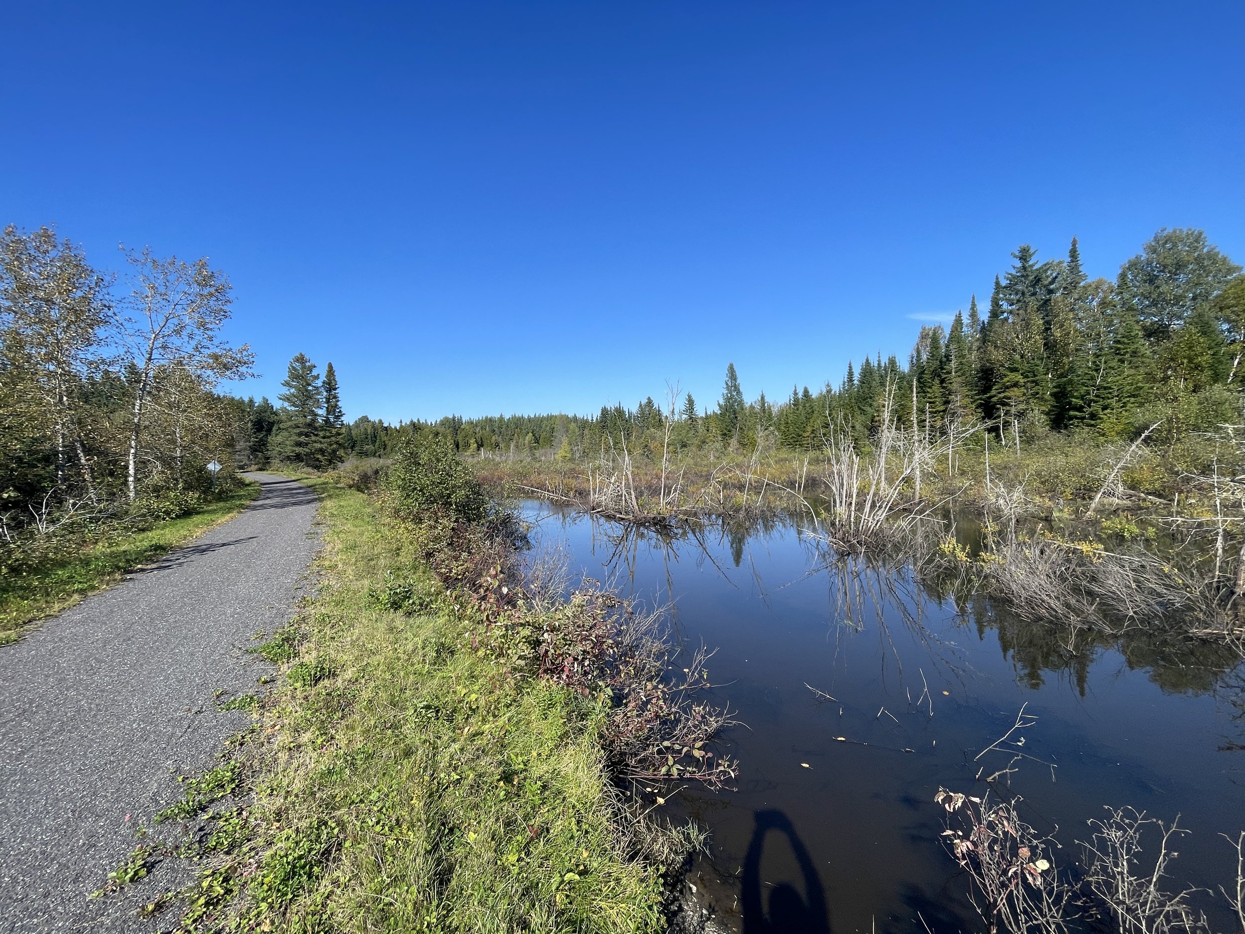
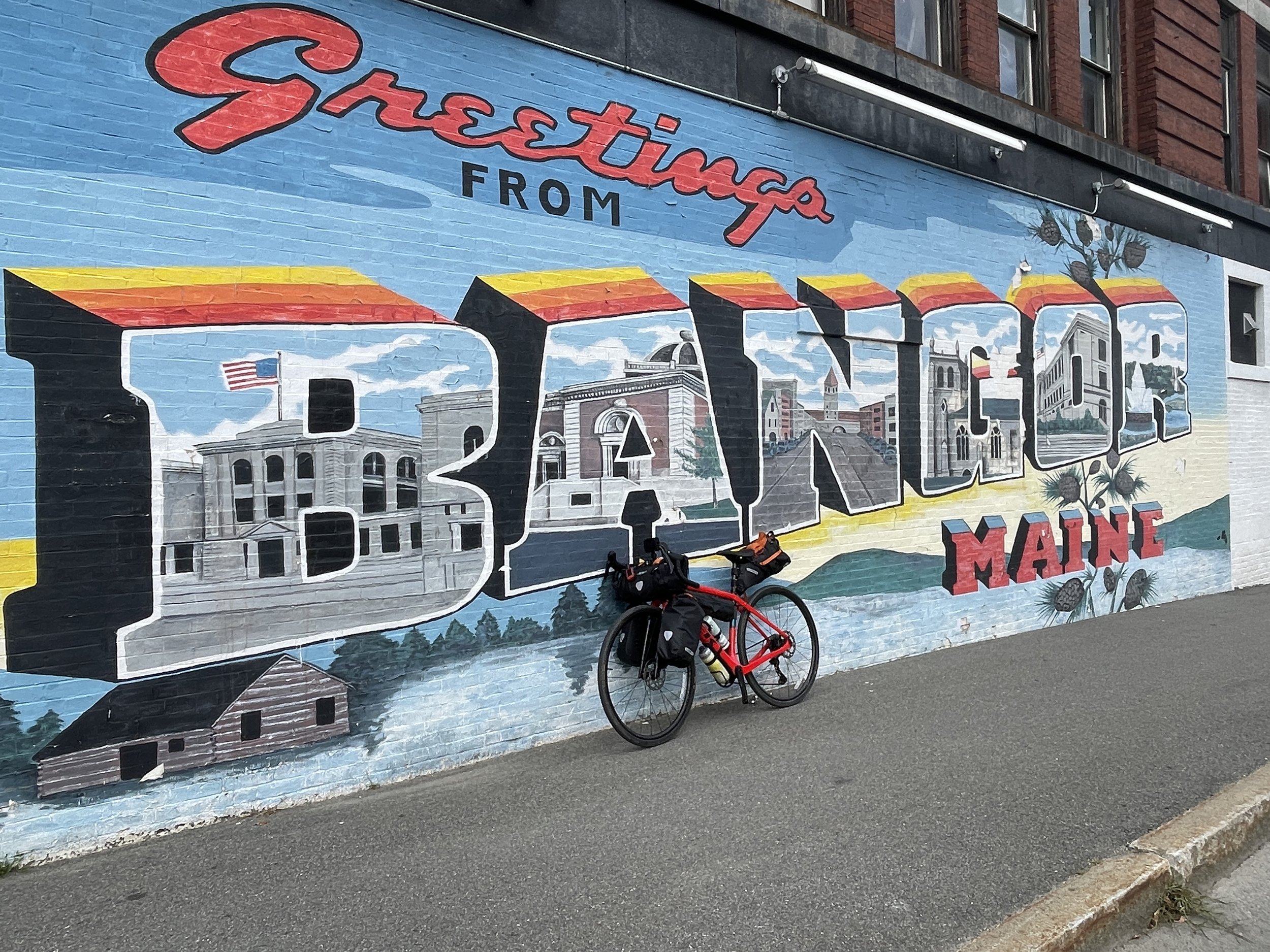
Although it was a pretty flat route, and flattening out all the more as I approached Québec. The bike trail got closer to the water, and now it was paved again. I passed several other cyclists, going both ways - people on their way to work or school, couples on their own journeys, and a couple squads of athletes in training who zoomed past me with the sound of ten ratchet hubs all spinning and chattering loudly in brash synchrony. Québec - the city and the whole province, is cycling country; often I would pass handwritten signs for campgrounds or simply wide lots that announced that cyclists could camp overnight for free. In fact, I remarked on how little I was remarked upon with any of the interest I’d encountered for many rural parts of Maine. “Right, guy on a bike, some bags, looks like he’s going a fair distance. <pfff> Ce n’est rien.”  

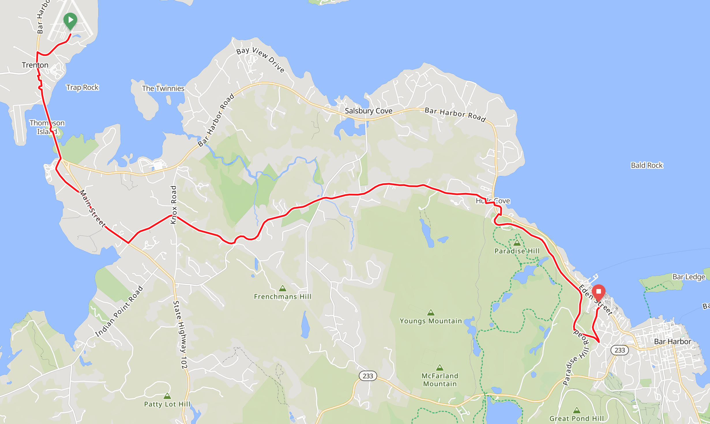
And whether the wind was relenting or my anticipation was growing, after I plugged in the final 18 miles of routing on my GPS, I was riding at a quicker pace. A few nights before, I’d accidentally discovered how to livestream on social media from my GoPro by using my iPhone as a hotspot. I knew my family would like to see the homestretch live, if they could. I amused myself trying to set it up, anyway. And hopefully I amused a few Facebook friends when, as I rode past the Ferris wheel in Quai Paquet, with the sight of Château Frontenac as it stood tall on top of the hill across the water, and realized my route had led me not to a bridge, as I assumed, but to a large, commercial dock. “Oh, I guess I’m taking a ferry across the river. Huh. Hadn’t expected that.” After all my planning, months of checking the route, building redundancy measures into my gear, scanning weather forecasts and consulting with people and organizations along the way, not to mention the over 3,000 miles of training I put in over the season, this last little bit somehow escaped my noticed. Not a bridge … but a boat.

I got to the gangway. The gate manager told me to dismount & I walked down the plank. “I’m sorry, I haven’t bought a ticket,” I explained & he pointed me to the window for cars (the bike ticket window was closed) and smiled as he checked the time on his phone. “You’ve got three minutes.” Challenge accepted. I sped to the window, quickly bought my passage, and returned to the gangway. He welcomed me aboard and I parked my bike by that of several other cyclists also on board. Tourists, commuters, students. A bike is a legitimate means of transport in this town. All the more impressive when you take into account how hilly the city can be. 

It’s a short ride across the seaway, about twenty minutes. I realized I hadn’t been narrating much of the streaming video, so I tried to add a little color for however many viewers were watching. I took a little stroll around the sections of the boat where I could walk, holding the camera up & out, panning it around like every single Times Square tourist you’ve ever seen. I didn’t even think about the fact that my trip was almost over. Barely even thought about the fact that I would soon arrive. I just tried to rest and watch the waves bounce off the bow of the ship, the gulls sloping in gentle arcs off the air currents.

Then almost as quickly as I’d gotten on, we were docking. The other cyclists start milling around their bikes. I went to get mine. I’d had to remove the bags on my front fork, so that the wheel would fit into the bike stand. I put them back on. I also had to get out my battery pack to charge my phone. Turns out live-streaming is pretty power-intensive, and I was running low. 

The ferry docked. The gangway opened. The twelve or so other cyclists walked their bikes up the metal walkway. I followed behind them. I stepped off the walkway and onto the pavement. And just like that, I was in Québec.

Which meant that technically I’d achieved my destination, but I’d routed my way to the entrance of Château Frontenac, at the top of a brutal climb. There was traffic, there were tourists, and there was construction. I rode as much of it as I could, but it was busy; I didn’t want to get in the way of cars driving up the single open lane or push past pedestrians walking up the hill. So yes, it’s true, I did not climb the whole thing on my bike. I got about halfway, and I was clearly going to be in the way. I got off and pushed Franco (and all the luggage he was dutifully bearing) about a third of the way, when the construction opened up & the tourists turned left to a staircase. And dammit, I would ride the last few hundred yards if there was any way possible.

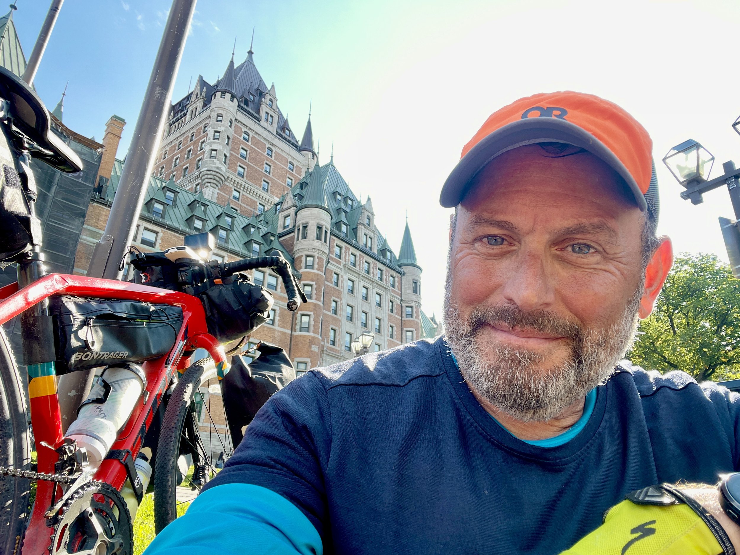
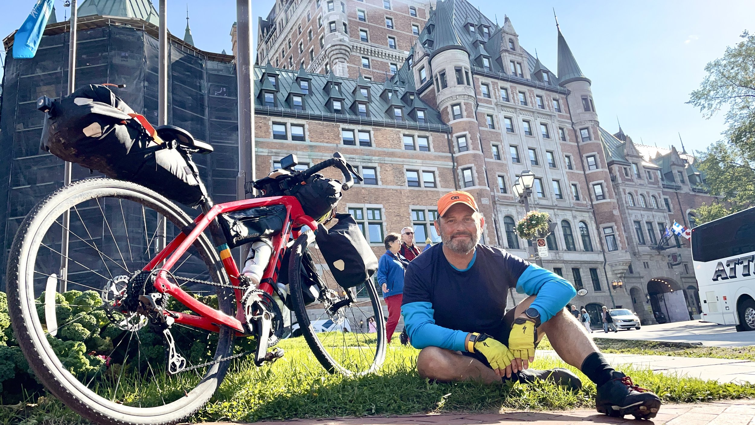
Cresting the hill, I squinted up at Château Frontenac which stood right in front of the sun on a clear day. Harry Potter’s first arrival at Hogwarts came to mind. Only, I was the one driving the Hogwarts Express. Driving it … Up… This... G*D... D@&^%D…. HILL…!

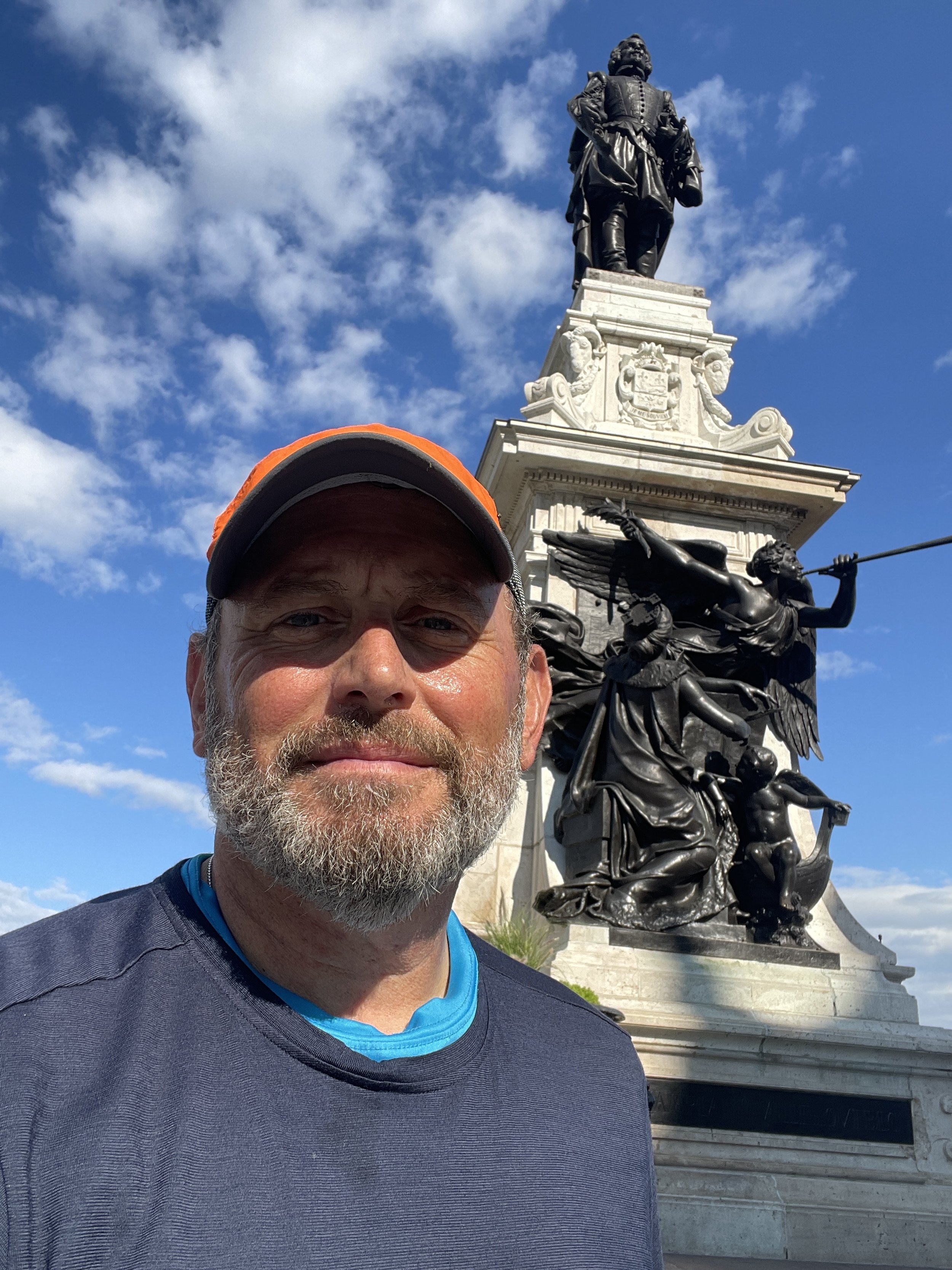
And then … I was there. I’d made it. Two weeks of riding and nine months of planning was, for all practical purposes, over. I took some selfies. I walked around Dufferin Terrace and stared up and the grand hotel just above it. I looked down over the wall at the Funicular du Vieux-Québec taking tourists up and down the hill so easily, compared to my most recent effort. I looked at the Monument to Samuel de Champlain, the founder of Québec, as a bronze relief of Victory holds a trumpet to her lips in honor of the indomitable explorer’s spirit.

I felt my muscles cooling, by breath slowing, my skin drying. I relished the moment. Momentarily.

And then the moment had passed.

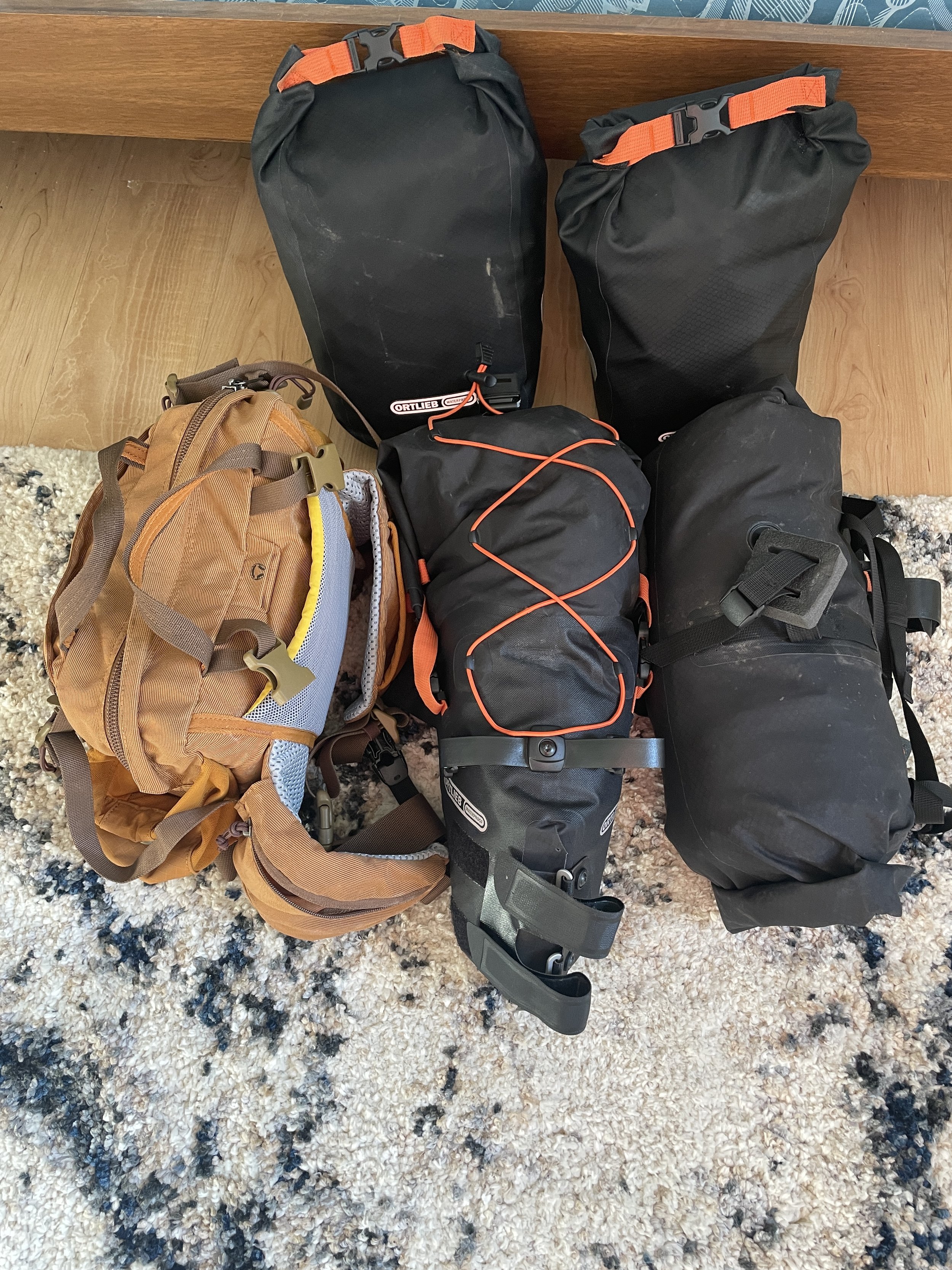
It was off to Vélos Roy-O, the bike shop I’d contacted a couple days before (and a couple months before that). I walked in and gave my name. I met Xavier, with whom I’d first corresponded back in March. He walked me through the procedure for checking in and dropping off my bike. I took off the luggage. I paid the fee. I told him I’d coordinate with the shipping service (I’m using something called BikeFlights, which had been recommended to me - I understand they specialize in handling bikes and are also good at dealing with the necessary customs and other paperwork involved. Fingers crossed on all that, but they’re a very well-established company with a good reputation, so I’m not too worried.) They wheeled my bike back to the shop. And after all this time of the two of us, working together and looking after each other through it all, I’m not gonna lie; it wasn’t the easiest part of the journey.

I loaded up my bags and walked a block to the nearest pub. I ordered a pint and started looking for lodging.

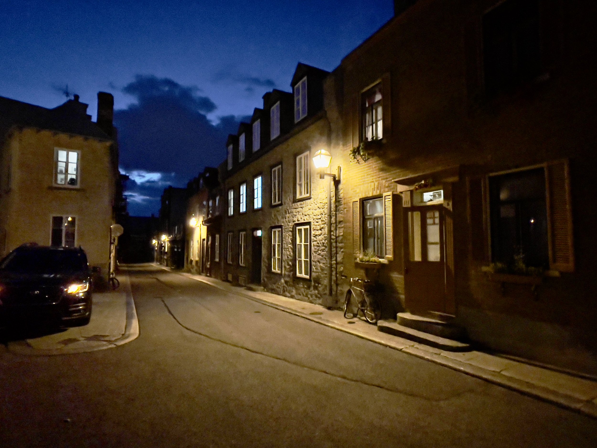
Although Québec is rife with WarmShowers hosts, I quit after writing to 10 of them and having no luck. People were either out of town, already hosting, or just not inclined to respond to my emails. I went on to booking.com and hotels.com and found options that were out of my price range. But then I lucked into what I thought was an apartment share but which turned out to be a proper B&B on, appropriately, AirBNB: La Maison Lafleur. Right in the heart of Old Town, on the second floor, with a flower-boxed window, a sink in the room, a shared half-bath down the hall, and a full breakfast in the morning. Booked.

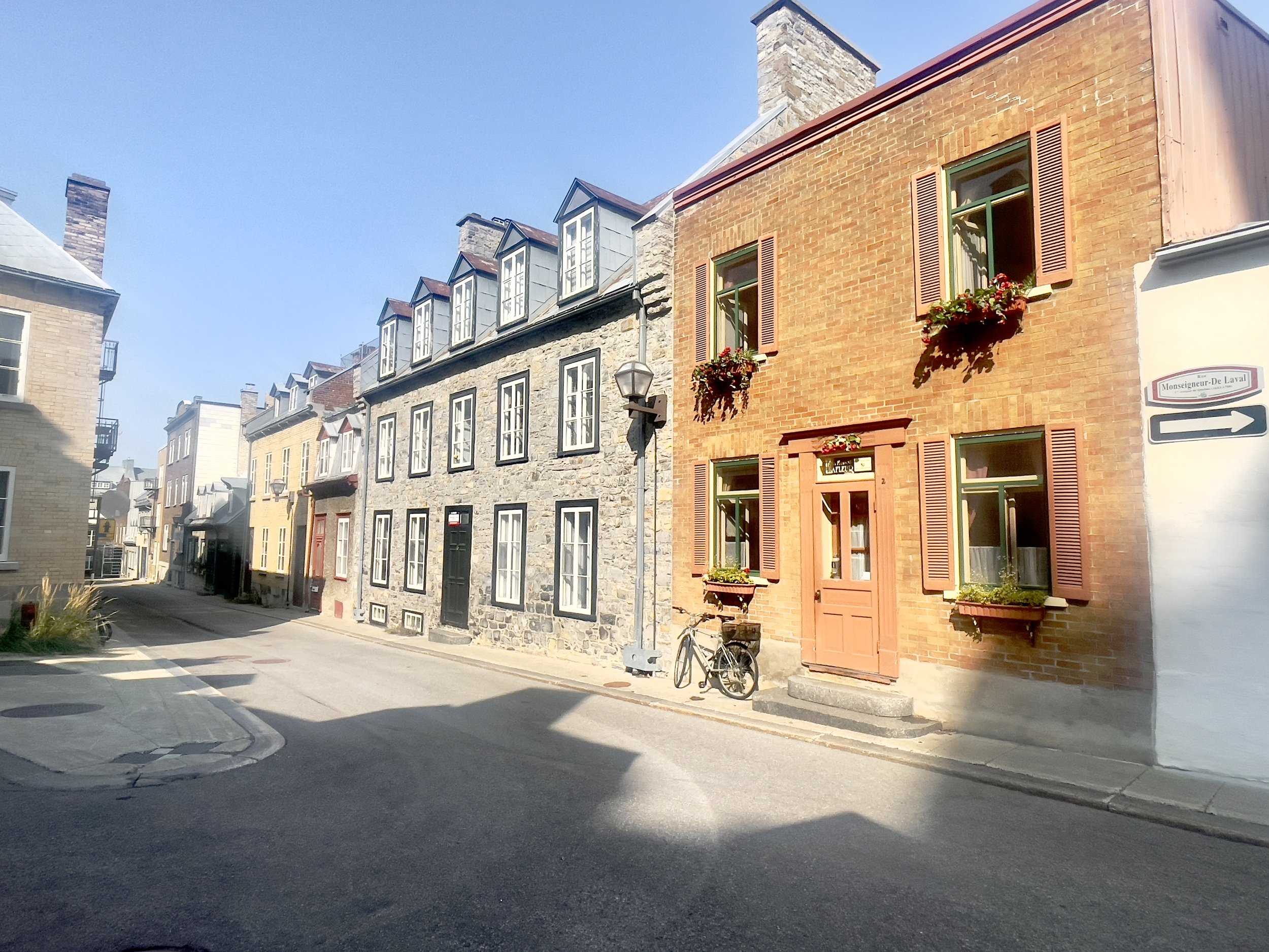
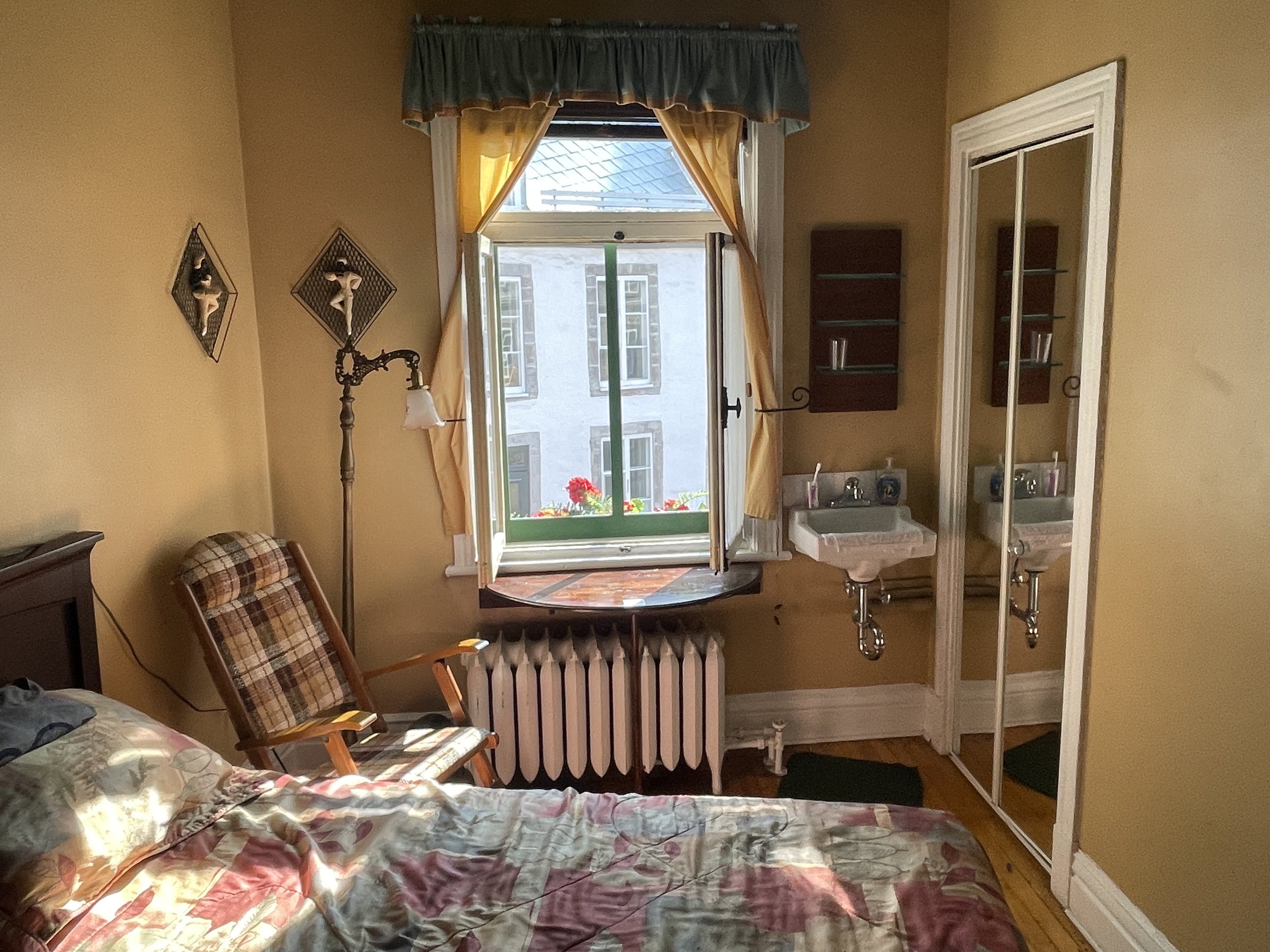
I hauled my bags awkwardly for the 20-minute walk to the B&B. Checking in, I was shown to my room. “Si charmant” was the phrase that came to mind. I dropped my bags, laid down on the bed, and laid quietly for a few minutes. There were still errands to run. I needed to find transportation back home. I needed to find somewhere to buy a cheap duffle bag in which to carry all my smaller bags together. I needed to coordinate placing the order and handling the paperwork to ship my bike. But these were simply that: errands. The challenge was complete. In a few moments, I’d get a shower, change my clothes, go for a walk around town, and get dinner.

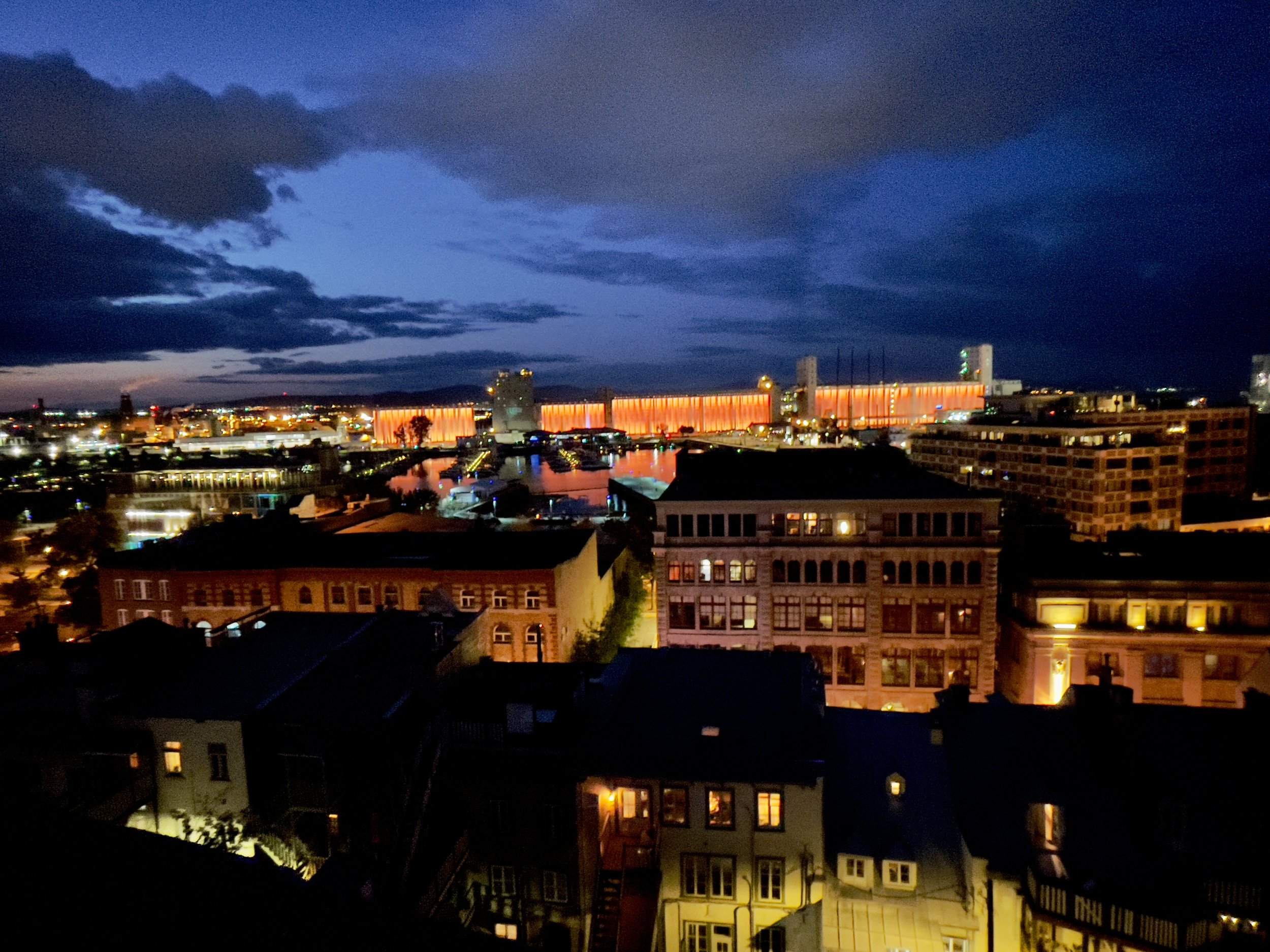
Even then, I could already feel the trip starting the shift from an active endeavor to a proud collection of memories. My body felt strong, if tired. My mind felt clear, if full. And the last of the afternoon sun, which I’d chased for so much of the last two weeks, fell warm and easy through the window before slowly revealing a blue evening sky.

… Les jeux sont fait.

Days Eleven, Twelve, and Thirteen

Right, ok. So, Hurricane done, more or less. The roads were dry (or drying) but the wind was still carrying on its harangue. I had about 25 miles of flats ahead of me before I got to Dégelis, which is where I’d meant to stop after Sinclair.

But since I’d by-passed Sinclair the day before yesterday in an effort to get ahead of the hurricane, and to keep as close to my schedule as possible, I figured I’d do the same with Dégelis and push on to Rivière-du-Loup, on the shore of the St. Lawrence Seaway. It made sense, although I wasn’t thrilled about the distance (it would prove to be nearly 90 miles) nor the long steady incline past Dégelis up to Demers or Saint-Honoré (about 20 miles or so). This wasn’t the ride I’d planned, but it was the ride ahead of me, so … saddle up.

Sure enough, though the first part of the route was flat, the still-gusting wind was an added challenge. Mostly crushed cinder and small rocks, the trail was also slower than a paved trail or hardpack dirt, which meant that I’d have to dig a little into each pedal stroke.

When I got to Dégelis, the real beauty of this section opened up. I found myself riding past B&B’s and municipal parks, with a well-maintained route that, if not paved, was made of such well-trodden dirt that it may as well have been. Clearly this part of the route - part of Canada’s “Route Verte” (Green Route) - was utilized regularly by local residents for dog-walking, jogging, and short recreational bike rides. Little rest-stop pavilions  with picnic tables popped up here and there and,  something I’ve not seen on a bike route before, outhouses. And not ramshackle porta-johns but clean, wooden structures with all the necessaries. Also always with a trash receptacle & recycling option that was similarly clean and always recently emptied. A beautiful path. (And a reassurance that bears were simply not going to be an issue in these parts.)

Later on, though, when I was past all the grand, sweeping vistas of Lake Temiscouata, and all the manicured lawns of the lakeside homes and tony B&B’s, the trail got rougher and rougher - then it eventually stopped outright. I mean, the trail continued, normally, but it was closed due to construction. And it wasn’t just roped off - there are gates in front of the trail which were closed an locked. There actually would have been a way around it, and often times I’ve run across trail construction that’s minimal, even though the trail is closed - but in this case, there was enough in the way of construction tape and official orange signs declaring “fermé” and “barré” that, were something to happen or were the way to become truly dangerous, I’d look like a real Yankee asshat if I’d ignored all that and just forged ahead.

So I doubled back a bit and started improvising a route along the road. There weren’t a lot of options (as there just weren’t a lot of roads, period) but I was certainly not going to take the freeway that ran to my left, a major vehicular artery from the Southern border to the sea. Instead, I started winding from side road to side road. Until … even the side roads stopped. Dead. I was right near another section of the trail, which still seemed to be closed, but there was really no other option. So I rode along a bit of it until I got to the other end of the closure. Detour done.

Or so I thought. A few miles later, another closure. And this time, my side road-routing took me to another road construction area. I rolled along dirt roads, past orange, reflective cones for a bit until the road seemed to stop completely, turning into dirt paths forged by the excavators parked in front of me. It was a smooth dirt path, but clearly not somewhere that motorized vehicles were meant to go. Here was where some of the real off-road capabilities of my gravel bike would come into play, I reasoned, as I carefully set out. Along what was starting to feel a bit like the Donner Pass.

Ultimately, the only reason I was able to go through this route was that it was a Sunday. This was a completely desolate construction zone. For better or worse, I suppose. Had there been workers there, I’m sure they would have waved me off. Instead, I rolled up & down what felt like a BMX trail for about 3 miles, sometimes on flat dirt, sometimes very rocky gravel, always keeping an eye out for anyone who might have a particular dislike of this route I’d chosen, scanning the road ahead for sharp drop-offs or shifting skree, and all the while thinking that if any of the drivers along the freeway 1,000 yards to my left were to glance over and see this lone cyclist riding alone through a Martian landscape of construction, they’d probably do a double take. Amidst all the wasteland and earth-moving machinery, I was an anomaly, to be sure. (I don’t have any photos of this area, btw. I’m afraid I had other things on my mind…)

Eventually, I made it back to solid, open trail. It had been a good 4 miles of up and down, back and forth, and as I cleared past the  cones and tape and “Route Fermé” & “Detour Barré” signs, I breathed a bit easier. And as I was now, according to the map, cresting the mountain, I should have a much easier time of it heading down to the water’s edge.

Which I did, all things being equal. I was still riding through crushed cinder and gravel, and I was still dodging routes, so it was still a bit like riding in sand, but I was on a proper trail and able to build up a rhythm on the descent. My only concern was that I still hadn’t secured lodging, nor had I found anywhere to stop for lunch, so it’d be Clif Bars and pedal-pounding until I got to Rivière-du-Loup.

Heading into town, I stopped at the first rest-stop I came across & downed a sandwich while I scrolled through hotel options on my phone. The two Warmshowers contacts for the area had both fallen through, camping wouldn’t be an option as there weren’t any campgrounds around & it was a suburban neighborhood that didn’t seem like the kind of place you knock on someone’s door and ask (in a foreign language, by the way) if you can set up a tent in their yard, and it was probably still going to be a bit wet and cool tonight.

But I was able to find a good deal at a nice place down near the shore and rode there, smelling the sea air blowing in off the St. Lawrence Seaway. The hotel was nice enough, in fact, that they asked me to leave my bike in a broom closet downstairs. It was a bit tough, leaving my constant companion for the last couple weeks, even if only for a few hours, but I felt better when I locked it to the shelf and headed up for the nightly routine of shower, laundry, and dinner.

Waking up early the next morning, I was under a new time imperative. There was yet another storm headed my way. I had 125 miles to go to Québec, and at 69 miles away, the quiet, seasonal town of L’Islet-Sur-Mer would be a good stopover spot. Rain was forecast to hit there by 6pm. It was also supposed to be the hardest downpour yet on this trip, so I didn’t want to be late.

I got on the road early and soon was heading down a wide-shouldered, county road with a mountainous edge on my left and a marshy barrier between me and the Seaway on my right. Traffic was minimal, and the cool air & grey skies of impending rain encouraged me not to tarry too often for photos, much against my instincts.

It became pastoral very quickly as I rode out of town. Wide swaths of farmlands also lay around me, particularly fertile from the groundwater, I’d expect. The horizon widened and I saw islands in the waterway that sloped gently out of, and back into, the water like humpback whales stuck in the middle of breaching.

The clouds and sun played tag as shadows and fog both came and went. And my route often took me away from the larger road to side roads through residential sections that felt a bit like a seaside English neighborhood - modest but manicured, simply apportioned but with beautiful gardens and misty views and surf.

Everywhere there was evidence of maritime culture, be it docks and harbors or buoys and widows walks. Driftwood sculptures sat beside park benches placed on the side of the road with no other view than the water in front of them.

Another common sight was public art. And by that, I mean not necessarily art that is publicly owned but which is publicly accessible. Religious statues and such, certainly (many towns in this area are named after saints, such as Honoré, Agatha, Jean, Denis), but also just expressions of a creative aesthetic. Hand-carved totems. Sculptures built of cornstalks and river weed. Designs in metal or tile.

It’s always gratifying to see people making things not for sale or official sanction but simply because they’re cool. I have often thought the primary goal of including the arts in education, for instance, is not to produce artists. It’s to produce an appreciation for art, to sharpen an artistic vocabulary. (Artists will grow out of that, of course. Some will make money at it, and some will even make a living. But the commercial impact from art shouldn’t be the primary motivating factor for arts education any more than should a nation of professional athletes be the goal for a school phys ed department. It’s a self-evident value, something that’s good for its own sake & just makes life more rewarding to live.)

On & on continued the weaving from highway to byway to bog road and back. Having gotten such an early start, I hadn’t had breakfast or even coffee. And I was having a hard time finding a convenience store. I stopped at a grocery store but it was only larger quantities. I just wanted a sandwich. (Coming out, an older local cyclist had seen my bike and wanted to stop & talk shop - he had a lot of questions about my luggage setup & wanted to talk about tech & such. His English was far better than my French, but we both did a lot of pantomiming about gears & internal cabling.)

Finally, I found a place for lunch and refueled. Back on the road, the mist in the air thickened. At a roadside stop, it turned to proper drizzle. I hunkered under a pavilion at a picnic table waiting for it to pass, but after about 20 minutes it didn’t show any signs of letting up, so I pulled out my rain gear and got on my way. I was 5 miles from L’Islet-Sur-Mer and didn’t want to get caught in a downpour.

Eventually I got to the AirBNB, just as the rain started to intensify. I showered, did laundry, and went to sort out the dinner situation. My two Clif Bars and a bottle of Gatorade weren’t going to last until Wednesday morning, when the storm would let up. Being a seasonal vacation village, there weren’t any restaurants in town that were open on a Monday. None that I could find, anyway. I found a grocery store 3 miles away, but I didn’t want to ride in the rain, in twilight, in cooling temps. Luckily I found a taxi service which was actually just a guy with a cell phone. A plan was forming.

I studied French in high school for a language requirement, but I never imagined I’d retain enough over twenty years to get directions and order concert tickets while on a trip to Paris with my then-girlfriend (later my wife). I never imagined I’d retain enough over forty years to give an address and directions over the phone to a taxi driver to the AirBNB where I was staying, or to ask a grocery store clerk where I could find canned soup or a loaf of bread, or that these four items which I brought to the checkout line I’d since decided I didn’t need.

David Sedaris has a lot of very funny material about him learning to speak French. A smoker, he tells a funny story in Me Talk Pretty One Day in which he sought to get a light by saying the French equivalent of, “Excuse me, but do you know where I could purchase a device with which one might make fire for the purpose of breathing smoke into my lungs?” I imagine my requests were not entirely dissimilar, thought I doubt they were nearly as funny. Nevertheless, I soon returned safe and dry with two days’ worth of groceries and a little less fear of the language barrier.

As I write this, I sit in my AirBNB as I have been here most of the day, listened to the movie-set storm pounding the roof and streets outside. I did venture out for a ten-minute walk to a local bike shop; I didn’t need anything, really, though I could use a small tube of chamois butter and a valve adapter, maybe a couple of meal bars if they had them. It was really just to break the monotony of staying inside all day; and I’ve gotten into the habit of visiting bike shops on my travels. I dunno - it’s comforting to be in the presence of some manner of like-mindedness for awhile, I guess.

Again with my Franglais, I got my request across to the shop owner. He asked where I was from and seemed impressed when I said New York City. I didn’t bother to disabuse him of the notion that I’d actually biked all the way from NYC; such an attempt would have had to include enough language-fumbling to bore us both, and it would only be for the purpose of a level clarity which didn’t really matter in the long run.  “Oui,” I said, “un gran voyage.”

Then I asked him, “Avez-vous un ‘sticker’ for ce magasin?” He smiled, because he totally got that I was souvenier hunting. He went to the back and came out with a sheet of little stickers they use for labeling their products, and he cut one off for me. “Bon, parfait. Merci bien,” I said. “Mais bien sûr,” he replied.

Coming back, the wind bent the trees and the rain drove at my back. I passed by the local maritime museum (closed until tomorrow) and “The Wreck of the Edmund Fitzgerald” came to mind. I got in and made another bowl of soup & finished the cheese & crackers. Tomorrow looks like it’s going to be beautiful. 55 miles to Québec. A little hard to believe that this trip is almost over. But I’m looking forward to one more good, hard ride ahead. You can imagine that a trip like this leads to all manner of philosophizing over all the miles. I’ll spare you most of it. With the exception that it has reminded me of something we all know - that we can only ever live in the here and now. Even if we could predict the future with some measure of accuracy (something at which we usually fail horribly), we can’t live it until it’s here. And while the past is something we can recall, it’s not always something we can interpret correctly. So its value is constantly changing.

Which is why tonight I choose to forget that this journey ends tomorrow. Because it won’t. Because it can’t. Because it hasn’t yet. And even when it has, like high school French, I may not know its full value for a very long time.

Days Nine & Ten

It was clear by the morning that my ride was going to be waylaid again at some point soon. This time by Hurricane Lee. I’d initially planned just to make it to Sinclair, which is a quiet vacation community on Long Lake in Maine. But I reasoned that if I could get to the border with Canada, stopping either in Madawaska, Maine or Edmundston, New Brunswick, I could ride out any foul weather in a slightly larger city and have better options for hotels, food, etc., rather than be forced to eat at the one place in town, with the only grocery store miles away. It would be a long day, with some significant climbs, but it seemed like the smarter target to shoot for.

Chris, my Warmshowers host, showed me how to get back on the Bangor-Aroostook trail and shave some miles off the route I’d planned (bypassing the town of Caribou, unfortunately), connecting back up with it up at New Sweden. Also, because it was a railbed trail, it was likely going to be a little less hilly. And as it would be largely lined with trees, there might be less wind (which was picking up quite a lot as the hurricane was pulling in air down from the North to feed it). The winds weren’t crazy - not just yet - but when it’s a headwind you have to fight all day, finding ways to dodge it can make a big difference, obviously.

There was an entrance to the trail right at the bottom of a pathway from their front yard. Getting an early start, I hit the trail, and this section was just as easily passable as the last part I’d ridden into town. It was great riding weather - brisk but not rudely chilly, with the sun struggling to come out. Absent the wind, it would have been perfect. I watched the forest roll by as I dodged potholes and roots.

When the route started to get a bit more rugged, just to confirm that I was on the right path, I checked the trail map that I’d downloaded the night before. I discovered that I’d missed a turn about 3-4 miles back. (The signage can be found a little lacking at some points along the way, but it could also just have been that I was distracted by the views.) Not a big deal, and easily correctable; I turned around and quite soon found a place to jump over between trails. But I’d probably added back some of the mileage I was hoping to save with this route choice. Regardless, I resolved to keep checking the trail map, along the way. Didn’t want to make a habit of getting lost in the middle of the woods when I’m trying to outrun a hurricane.

The path was really pretty gorgeous. Old wooden bridges, which looked like they may have seen a few harsh winters but which also looked strong enough to see a few more without needing much tending, appeared at several points along the way as I rode over the creeks and ponds. The terrain was littered with weatherbeaten tree trunks half submerged in various waterways or scraggly patches of scrub brush fields that broke up the monotony of pine trees standing side by side like soldiers on parade.

Eventually, at New Sweden, I got back onto the route, which now had me riding up state route 161. This was going to be one of those stretches where I’d be sharing the road with cars. To be fair, they were pretty good about giving me plenty of room, but still … feh. It’s fine for a mile or two, but unfortunately, this was going to go on for a bit. Just a feature of the limited options for routes.

I grabbed lunch at a convenience store in New Sweden and got back out on the road. Funny, until recently I hadn’t actually stood for a meal since I ate a Gray’s Papaya somewhere in midtown, but it’s become the norm on this ride in terms of midday refueling; I’ve often had to stand & eat outside various delis and gas stations, balancing a sandwich and bag of chips on my saddle. Just as well, as I usually want to get rolling again as soon as possible, before I cool down too much.

Once I hit the intersection of 161 and 162, traffic lessened. Which was good, frankly, because so did the shoulder. Eventually I was riding along the shores of Mud Lake and then Long Lake, looking at a series of lake houses and RV parks, some which seemed like summer homes, some which may well have been year-round. I don’t know how long the lake is useable for water sports like water skiing or jet skiing, or whether there’s ice fishing in the winter, but I imagine the quiet and respite of a lake house is valuable if only for the idea. It would seem so, given that many of the homes were simple mobile homes or overbuilt sheds. Woodshed or mansion, a house on a lake is a House on a Lake.

All along this stretch, both 161 and 162 as I pulled away from Sinclair and Long Lake, I was met with the inclines that told me I was getting close to the border, the hills I needed to cross before I could get to the St. John River that divides the US and Canada. French Canadian influence was cropping up everywhere. Bi-lingual road signs, distances measured in both miles and kilometers, accented English mixed with broken French among travelers at rest stops, and references to Acadian culture or people in the historical markers along the side of the road.

Finally, the last stretch of unpaved road I was destined to ride in the United States (on this trip, anyway) began at the foot of a long, grueling hill of two miles, climbing over 1,500 feet (with several dips and recoveries along the way) on an incline that topped out at around 9% at points. At the bottom of the hill was a warning that this road is closed during winter months. I didn’t doubt it. I wouldn’t want to be gingerly sliding down it on a sheet of ice in the middle of January. But to get around it would have added too many miles, and incurred too much traffic. This option was as voluntary as it was brutal.

The thing about Maine, though, is that - on the whole - it’s a flat state. By which I mean that any elevation gained on a hill is usually matched quite soon with a roughly equivalent descent on the other side. You don’t typically climb somewhere here and stay at a new elevation - the hills, challenging though they are, are just interruptions in the terrain, rather than ramps into a new level. And I had a great slalom down the other side into the industrial town of Madawaska, right on the border.

Then, I turned a few corners, a left at one deli, a right at an industrial building of some sort, rode a quarter mile through a drab industrial stretch, and boom - I was on the bridge to Canada. I could have been on a bridge to another side of town, for all its lack of hoopla. I could have maybe made a pedestrian crossing and just walked my bike, but I rode across. Funny how some transitions seem so huge for so long until you get to the point where you’re actually, finally, making them.

I didn’t amuse the border guard when I couldn’t tell him where in Edmundston I would be staying, where in Québec I would be staying, or even when the date of my departure was. It’s certainly not illegal to enter Canada with uncertain plans, but … I think they’d rather you had one. Oh well, too bad.

Crossing the border, I went to get a scoop of ice cream and look for a hotel. It was only when I got the register that I realized, in my joy at having made it all the way to Canada, that I had forgotten to change any US money into Canadian dollars. So I paid for an ice cream cone in US without taking advantage of the exchange rate (ah well), and sat down with my phone, scrolling through the limited hotel options I could find.

The hurricane seemed to have encouraged everyone to find a place to hunker, but I managed to find a room at a Comfort Inn in a more industrial stretch up the hill from the town center, and I rode straight there. That night, I watched whatever weather reports on the storm that I could find as I charged all my devices, and I went to sleep knowing I’d just have to see what the situation was in the morning whether I decided to push on or stay in place for a day as the storm passed by.

The next day, I woke up early and went downstairs for breakfast. Stepping out the front door of the hotel, I checked the weather. Though still dry, storm clouds poured and the wind sharply snapped the New Brunswick flag on its pole in the parking lot. Looked like an ‘enforced day of rest’ for me. Heading back in for coffee and whatever was on the menu, I figured I’d be alone. It was just after 6am, as I’ve gotten into the habit of rising early to maximize daylight riding hours. I could read the paper on my phone, or whatever. Walking past reception, I saw sitting on a table outside the breakfast room I saw what looked like four oddly folded black napkins, each in the shape of something like a vase or upside down bonnet. “Odd,” I thought to myself. Then I walked inside.

Twelve older Mennonite (I’m guessing?) folks sat silently fueling up for their trip at an hour to which, I’m guessing, they were not nearly so foreign as I. All of a sudden I felt like I’d walked into a farm kitchen - one that just happened to have an orange juice machine and waffle maker. Now, I share the same fascination as anyone might with the concept of ‘the other’ - it’s a curiosity that calls into question my own habits of how I go about my life as much as it does about how they go about theirs. I also wonder how much of any of us structure our environments and behaviors intentionally or habitually. And whether a deviation from a specific norm can seem radical within one culture while unnoticeable in another. For instance, why did some women have simple, black, seemingly handmade shoes while others had sneakers? Is it a nothing difference to them? Is there a financial reason? Does it signify anything about a resonance with (or resistance to) the more commonly seen secular culture around them? And is there any difference between that variation and that of the four young teenagers sitting in the other corner, three with black goth denim and spikes and one in a pink sweater and gold jewelry? The things that link what we perceive as internal differences are maybe the dialog which should define someone within a particular culture, rather than what we perceive as the difference between that culture and our own. We are born into a culture - we move through each culture, and make choices within them, as individuals.

Fed and caffeinated, I went back upstairs to watch more weather. I sat down on the bed … and woke up at noon. Clearly I wasn’t done resting. And I went out just long enough to find an ATM to get Canadian dollars and to find a truck stop where I could use a hose to wash the grit off my bike.

I returned just as the weather thrown off by Hurricane Lee was hitting, and I spent the rest of the day tending to things. Laundry, re-packing, charging devices, catching up on the blog. I fell short in my photo record, because … well … we all know (or can easily imagine) what the inside of a room at a freeway Comfort Inn can look like, yes? #nuffsaid

Day Eight

Another long post, but (as you’ll read about later) I’m hunkering down in Edmonston, Canada, waiting for Hurricane Lee to finish battering the coastline and wrecking the weather all across Maine and Southeastern Canada. So … I have a little time on my hands… Enjoy!


Houlton to Presque Isle

With the rain relenting from one storm, I was now growing aware of the steady Northern march of Hurricane Lee. But the one constant of all the weather forecasts was their variability and mutability: it was kind of anyone’s guess what Lee was up to. I certainly wasn’t going to wait around to find out, and with the skies clearing I could make my own Northern push and see how much of the hurricane I could outrun.

Rolling along, I was now heading into Northern Maine which presents very different geography and culture. The horizon grew as the yards lengthened into potato & kale farms, places where the vegetables are all about as durable as the people who grow them. It’s a tradition up here that kids in school often get a week or two off to help with the potato harvest; and not just from their own farm, but also from neighbors’ farms as well. There’s pay involved, apparently, but it’s not the main driver of the custom. It’s a part of the culture up here. I rode past acres and acres of fields, many of which, brown and loamy, seemed like they’d either been harvested already or had been left fallow for the season. Don’t ask this city boy what crops were there, although I didn’t notice the purple potato blossoms I’d been told to look out for (the state flower of Maine, apparently). But I did see plenty of acreage of thick, dark green kale, as well as signs for “new potatoes” for sale by the side of the road, which made me smile. I wouldn’t think of “new” as a way to describe a vegetable (“new carrots,” “new eggplant”) … but then again, I can’t say that “fresh” potatoes would be a particularly common description for a potato, either. So on balance, ‘new’ seems like a perfectly appropriate description for what I’m assuming is a ‘recently harvested’ potato.

These are the kind of thoughts which one may find oneself entertaining, while cycling radio-free through the wide-open fields of Northern Maine. This one, at least. Judge me not.

And I’d planned a good route to get to Presque Isle from Houlton. Not that there are a lot of options. the whole left side of the state is logging. Private land, though accessible by cars. But off-limits to bikes. Collaborating on my route with Erik daSilva of Bicycle Coalition of Maine, I kept sending him route options that had me turning West and heading into Québec. “Yeah, you can’t do that,” was always his response. There were clearly marked (if unpaved) roads all through there, but apparently the North Maine Woods is a hyooooge tract of land that’s privately held by various logging companies. Any cyclist that dared head down one of those roads would be playing chicken with multi-ton logging trucks thuddering (simultaneously thundering and shuddering) down single-laned roads with walls of straight, tall pines on either sides and not a hint of a shoulder. It wasn’t apparent from the maps I was seeing online, so Erik finally sent me a map that clearly delineated “thou shalt not pass” territory for bikes. It was like looking at the lands Haunted Forest, North of the wall in Game of Thrones, somewhere I might just find John Snow fending me off with a white wolf.

Soooo, hence my reasons for heading east out of Baxter State Park. And now I was free to go North, but there are really only a few main county roads. They’re not bad biking, really - they have wide shoulders and I felt perfectly safe, even with some of the heavier industrial traffic that moves along US Route 1. It’s just a drag when you’re having your bucolic pedaling interrupted by the roar and wind of a cement truck or semi pounding down the road to your left.

However, if you look at the maps, there are many places where you can jump off the main route and take a county or residential road that runs parallel to US 1 for a few miles. You take that for a bit, get back on 1 for a mile or two, then jockey over to another such road for several more miles. These are roads that go past farms, farm equipment shops, farm supply shops, tack stores, convenience stores, and slightly wider parts of the road with gravel turnoffs just adjacent which purport to be towns, although some are identifiable as such only by a post office or a building with an official sign of some sort. I passed by one structure that was barely larger than a shed you might order at Home Depot and have delivered to your property, somewhere to store your riding lawn mower and ATV.  Maybe some cord wood or feed for the goats. Then I saw the sign out front: “Town of Blaine, Inc.” Population 667, as of the 2020 census. Go Blaine High Bengals.

This whole latticework of side roads was great bike-touring land: wide vistas, roads that didn’t even bother to paint a line down the middle, because why? What traffic is there to divide? And a chance to see, at 15 mph, the homes, lives, and livelihoods of people living up here in “The County.” Which, by the way, is the Mainer’s way to refer to Aroostook County. There are many counties in Maine, and several unincorporated townships and rural areas, but there’s one big county to the North that sits like a Yeti at the top of the mountain: Aroostook. “I’m goin’ up county.” “You from the county?” “Down east is one kind of weather, but the County’s a whole diff’rent story.” The meaning is always understood.

In the town of Bridgewater I clocked a piece of something I’d read about but forgotten.  A planetary model stood high on a mounted pole with a plaque below. “Uranus,” with a web address for mainesolarsystem.com and a QR code. Billed as (what I certainly don’t question) “the largest 3-D scale model of the solar system in the western hemisphere,” it’s a series of planetary renderings all in scale - both in size and proximity/distance to each other - of the planets in our solar system that we all learned about back when our Very Energetic Mothers had Just Served Us Nine Pizzas (hence Pluto is included…) I’d missed the first two because I was busy taking side roads, but in Bridgewater there I was, staring up at Uranus. (Cue all nine-year-old sniggers here. Mine chief among them.) I also caught Saturn in Westfield, right after I had ridden through the town of Mars Hill - a town in which I really hope Stephen King sets one of his more sci-fi novels, because … obsvee. The models continue for 100 miles, all the way up to Presque Isle, with the Sun being located somewhere on the University of Maine, Presque Isle campus.

I didn’t get to that, though, because I was more interested in some of the byways. I’d also been compiling a mental list of all the things I needed to attend to at the next proper bike shop I could find. Check tire pressure, new battery for my pressure gauge, some chain lube for wetter conditions, a changing cable for my Garmin, etc. And up ahead in Presque Isle was Bike, Board, & Ski - the best (and only) proper bike shop in Northern Maine. I’d reached out to BBS months ago, for insight into route options and trail conditions, and I’d been referred to them by a rep from Bike Coalition of Maine as a reliable resource with local, on-the-ground knowledge. So as I pedaled on, I ran through the checklist in my head, so as not to forget anything.

Part of my route into PI was along the Bangor-Aroostook Trail, a dirt & gravel route I’d initially looked into but had been shied from at first because (apparently) some cyclists had complained about there being a lot of dust on the trail kicked up from ATVs. So I figured I’d try this stretch, for the last 10-15 miles into PI, to see if I agreed.

I didn’t. At all. Granted, I was riding mid-week, after Labor Day, and after there had been some wetter conditions. But I had no dust, no ATVs, no encounters at all, in fact. And maybe that’s the thing - when you ride the trail could be a crucial factor. I had, apparently, picked the perfect time.

Also, the Bangor-Aroostook is a converted rail-bed trail, maintained by the state. Some of the ATV trails I’d ridden mid-state, by Mt. Chase, felt like wartime routes frequented by nothing but jeeps - but I learned that there are state-maintained routes and club-maintained routes. The clubs I refer to are ATV and snowmobiling clubs who make it their own business to maintain (or let crumble) the various routes. The clubs are MANY up here, and some want their routes rough and difficult to pass; that’s the fun of them. Others are laissez-faire about it. Yet others are more conscientious about grooming their trails. State-maintained trails, however, are held to a greater standard of accessibility, with more reliable grooming. Plus, they’re often built on old railbeds, so they’re typically less hilly and originated, at least, from more even, less rugged terrain.

Instead of the trials I’d had back West, this route was a breeze. There were still potholes to avoid, rough terrain I wouldn’t want to ride on a road bike, but with vistas, long stretches of simple, smooth, unpaved ground, and the unalloyed silence of solitary, backcountry riding.

When I got to Presque Isle, I went straight to BBS. And what a great experience. Noah, the tech, knew all about exactly every issue I wanted to ask. He also had terrific recommendations for local craft beers (which they sell in the shop - who doesn’t love a bike shop that considers beer a standard bike accessory?) Melissa, who was restocking apparel, discussed the Northern Maine culture with me and shared some recommendations for restaurants along my route as well as where to get a good whoopie pie - a Maine-specific treat that’s kind of a circular, brownie-cake sandwich with a particular kind of thick cream filling inside that’s wet and packed just like the snow that every skiier hates. And after I’d spent a good hour and a half at the store (solitary trail life had left me a bit wanting for conversation it seems) Mike, the manager (and I think owner?) of the shop personally walked me and Melissa to Governor’s restaurant for a quintessential, authentic, full-calorie whoopie pie which he paid for himself. Because that’s what Maine hospitality is like. Or at least in Presque Isle.

So, beer-ed and sugar-ed, with all the tech seen to that I needed, and with a new Bike, Board & Ski t-shirt I’ll proudly wear down to the threads, I headed the few miles on to the home of the Warmshowers host (Chris) who’d offered me a place for the night.

Now, I’ve mentioned a friend of Maine origin who’d given me specific tasks for my journey, not the least of which was having an authentic whoopie pie. That friend is John Cariani, the Presque Isle-born actor & playwright, whose ALMOST, MAINE I’d helped premiere of off-Broadway in NYC back in 2005. (John gamely did a Zoom quiz for my fundraiser that you can see HERE.)

It turned out that the Warmshowers host was a high school classmate of John’s and had, in fact, had breakfast with him the last time he’d come home to visit, a year ago! I asked Chris and his wife Denise to help me finish this ginormous whoopie pie for dessert (after we had the white chicken chili that Denise had made), and we took a selfie and sent it to John, without comment.

John being John, of course, he immediately recognized Chris and Denise … and the whoopie pie. “Hey, Governor’s! A Maine landmark…” he commented. But then, apparently, he recognized me. “Wait, is that Todd Cerveris?!?” John then texted me. “So glad you met Chris and Denise! Great people!” “I didn’t just meet them,” I replied, “I stayed at their place!” Somewhere in the Bronx, where John Cariani lives, there was doubtless a guffaw as the world shrunk instantly.


The wide open fields North of Houlton…

… every ride has to have at least one nine-year-old giggle in it …

… the Bangor-Aroostook Rail Trail

… imagine being on a train back in the day, wending your way through this landscape.

It took three people to finish one whoopie pie.

Days Five, Six, and Seven


Author’s note: Apologies in advance for the length of this post. I write these for myself, as a diary of the ride, but in the name of all that’s holy, bail out when it gets boring. There’s no prize in finishing, no shame in skimming, and I won’t be giving a quiz. 🙃


My initial plan for the end of Day Four called for it to end in Katahdin Stream Campground, in Baxter State Park. The first of two nights of camping in the park. In fact, on my ride into Millinocket from Medway, I’d stopped at the Hannaford’s to pick up food, ready for a little backcountry gourmet. But, with the onset of rain, and the uncertainty of the terrain, I’d decided to cut the day’s ride short in Millinocket, putting me behind a day in my schedule. Of course, what’s a schedule for a trip like this, except really just a point from which to begin an improvisation?

Waking up and getting ready in the Appalachian Trail Hostel & Outfitters, I heard trail stories coming from every room. Thru-hikers were comparing their best encounter, their best soaking wet campsite, their best emotional outburst at the completion of their hike on top of Mount Katahdin. Sleeping bags which had been hung up during the night to dry were being stuffed back into their sacks. The sound of unlaced boots shuffling across the floor and down the stairs filled the spaces between bits of muffled conversation. They conversations resumed as they waited for the van to take them to Bangor or other points South, bound once again for ‘real’ life.

Anyone who’s been to summer camp as a kid knows the scene: the smell of wet hardwood and dirt in humid summer air, the sound of slow-drizzling rain in early morning hours, the quiet of a group of young people waking up, laughing occasionally, shushing each other, galumphing about with neither sensitivity nor malice.

Once gone, I finished packing my bags and loaded them back onto my bike. I settled my tab and pulled out of town. The rain had relented (though the mizzle was moderate) and it looked like there might even be some sunshine on the horizon.  I stopped for a selfie on the side of the road in front of a large boulder painted with a “Keep Maine Beautiful” mural while a couple of women climbed out of a Jeep about forty yards away.

“You want me to take your picture?”  “Yes,” I said, “That’d be great! Thank you!”

She and her sister had been coming to Baxter State Park for years, since they were little. “We’re Maine-iacs,” she said proudly. “It’s a family tradition - she stops here and picks flowers before we get into the park, and I take pictures for tourists.”

Photo done, she asked where I was headed. “I’ve got sites reserved at Katahdin Stream and Trout Brook Farm. Thought I’d see how far I got today.”

“Trout Brook? That’s all the way on the other side of the park,” her sister offered. “Be a real long ride for you.”

“Well, like I said, I’ll see how far I get.”

I rode the 15 miles or so to the entrance of the park and rolled up to the gate. A sign told me to Please Stop and Turn Off Your Engine. I unclipped from my pedals. The ranger came out to greet me.

He explained the need for a misnamed “dash pass” I had to help him fill out and keep with me - a record for every park visitor, so they can keep track of everyone going in and everyone going out. For emergencies, etc. Though some of the questions weren’t really relevant, he asked them anyway, amused by their inappropriateness.

“License plate number?”

“How many in your party?”

“Are you carrying any firewood?”

Every question was followed with an amused chuckle, to himself as much as me.

Riding off, I hit the gravel road soon enough. This was one of the long-anticipated parts of my journey: the Park Tote Road of Baxter State Park. Crushed gravel and long, empty, wooded, winding roads for miles and miles. The road cuts through the forest like a hallway with that kind of wallpaper that every tacky country restaurant in the 70’s had on the way to the bathroom: that kind of treeaftertreeaftertreeaftertree with a symmetry and linearity that no forest ever actually has. But Baxter does. The road is walled on either side with thickets of trees one after the other so close together that not only could you not throw a stone further that 20 yards in any direction, you would likely need a headlamp to see your way through them, so think is the overhead canopy. And lined with a thick shag of moss all along the ground. “Thick as a bear’s fur,” I thought to my self. Storybook. Tolkien-esque. Elves and wood nymphs hid from my sight as I rode past.

Boom. Oh, right. The second of three reeelly big climbs I’d have on this tour. The first was up Cadillac Mountain. The last will be heading up and over the mountain between the Canadian Border and the St. Lawrence Seaway. And then this one - heading up about 1,500 feet over gravel the size of golf balls and divots in the road that you could hide a volleyball in.  About 20 miles of that, all told. I did pretty well. But I reminded myself, as I unclipped halfway up one particularly step stretch, “There’s no shame in walking.” And on a 13% grade, with 25lbs. of gear, and with skree spinning under my tires meant really more for hardpack, the motto rang true enough to be sure.

But one thing I’ve noticed about riding the hills (and mountains) in Maine is that an uphill rarely plateaus and is instead usually followed by a commensurate downhill run. And I went flying down the other side of the mountain, with the kind of speed that I actually couldn’t laugh out loud about because I actually had to watch the road very carefully, knowing that the gravel that spun under my tires on the way up was lying in wait to thwart a smooth descent on the way down. Standing up in your pedals a few inches above your saddle, letting the bike bob and weave on its own while your legs take the shocks, is the smoothest way down a hill like that.

Quickly I came to Katahdin Stream Campground. And who do I see but the same women I met at the painted boulder, just getting out of their Jeep. They seemed more surprised to see me than I was to see them. “How’d you get here so fast?” One exclaimed. “And look at you, you’re not even winded!” It was true, actually, but only because I’d spent the last three to five miles on a beautiful, un-pedalled descent.

Muddy, clotted schools of hikers milled around the ranger station, apparently just back from a summit or planning their ascent. It was the same hiker culture I’d just left, and more power to them, but … I was looking for a less populated evening. I broke for lunch at a picnic table and got right back out on the road.

I had 25 miles under my belt. Another 35 lay ahead of me. And as I rode, the mist got thicker and even rained at some points. But I was determined - by getting to Trout Brook Farm that night, I could stay on my schedule AND get a more secluded campsite. Road grit and puddles be damned.

Clouds obscured most summits from view, but the soundtrack of my ride, beyond the rushing air, was that of wide streams rushing through grooved valleys on either side of the road. Occasionally the gusts of wind sounded like traffic about to overtake me, but the road was pretty sparsely populated. And when I made it to Trout Brook, the ranger station was empty. I rolled through to my campsite and didn’t see a soul around. Out across a field, down through a wooded thicket, across a rickety bridge, taking a little side path, and into a clearing.

I was able to set up camp & make dinner just in time before the rain really began. I got into bed just after sunset and listened to the rain fall on the tent. It was laughably warm and dry inside the tent, but anytime I had to leave & return (bathroom break, something I forgot on my bike, it was a careful process of foot-wiping and deft handling of the rainfly vestibule before I could get back in and hunker down.

With the cloud cover and tree canopy, the night was jet black. And the rain seemed to keep the wildlife pretty quiet too. This New Yorker had to listen to a few podcasts before his brain would turn off enough to go to sleep. When I did, I would occasionally wake from the sound of a tree branch snapping or something else, but I was never really all that nervous. My food was hanging in the branches, over 100 yards away, I had bear spray in the tent, and after the long, rainy ride I’d had, I was too tired to waste any extra energy on free-floating anxiety. Besides, bears don’t want to see you any more than you want to see them.

The next morning, the rain was still continuing. And my tent was still warm and dry. And because I had the site reserved for two nights, I weighed the possibility of just staying, horizontal, in my sleeping bag, all day. The two problems with that were that 1) as my wife will attest, I am not someone who does well at doing nothing, and 2) I had no idea what the weather the next day would bring. So I got up & walked to the ranger’s station to get the weather report. Turned out, that day would likely be the better day to ride. So, I hiked back to my site to break camp - which, in the rain, took twice as long as it normally would.  But eventually I got out on the road.

Coming out of Baxter through the North end at Matagammon Gate, I rolled past a mountain deli/restaurant/lodge/kinda place. I stopped for coffee and a roll. It was clearly the place where everyone knew each other, and they all looked at me, soggy and muddy and clad in cycling gear, as someone to pity or avoid as they climbed, flannel-clad and collars turned up, into or out of their Tundras or Silverados or Expeditions, caked with mud on the outside but with dry, probably heated seats on the inside.

My goal was to get to Houlton that night, but there are no easy roads straight through. I’d either have to go a long twisty route or ride through a latticework of ATV trails. I had plotted a course through the latter, but I would never do so again on the bike I’m on. Not after already getting a late start. Not during a rainy day (even a light rain, like the one falling then). And not by myself. The golf ball-sized gravel had become fist-sized, and the divots now large enough to hide luggage. And the trails would wind this way and that and my GPS was slow to respond, so sometimes I had to go what I was pretty sure was the wrong way for a bit before the computer picked up the course again and corrected itself.

Suffice it to say that, after a rugged day of riding, getting soaked through to the bone, and racing to make it to my destination before sunset, I was exhausted. (About 7 miles before I got there, I passed a metal salvage or auto body shop with a big sign out front. “He who endures to the end will be saved. Mark 13:13.” I took it as heavenly inspiration.) And I spent the rest of the evening doing laundry, hanging out camping equipment to dry, and taking stock.

The weather reports showed a bad day for riding coming up, so I had an ‘enforced’ rest day in Houlton, today. I took my bike to a self-service car wash to hose off some of the mud & silt. I got some additional AAA batteries. I got a beer to have with my dinner. And I cooked the last of my camp food. And now, here I am, rambling on (and on and on).

The goal for tomorrow is Presque Isle. As I write this, Hurricane Lee is crawling up the Eastern seabord, headed for coastal Maine. I’ll be well inland, but it’s going to affect the weather for sure; I’m just taking it one day at a time. (And I’m done with camping until I get a night full of stars…)


Lots of wide, slick rock rapids…

… and this was some of the EASIER gravel I had to ride.

The Tolkien-esque woods of Baxter State Park.

Well, it’s not like I rode my bike across the bridge to the campsite.

Time to make my dinner and my bed…

And that was just the first day.

Warm & dry inside!

Finally out of the ATV trails, it was a long, straight county road to Houlton.

Thanks for the pep talk, Mark!

‘Enforced’ day off in downtown Houlton…

Days Three and Four

Perhaps unsurprisingly, I haven’t quite nailed down the whole blog-posting-while-bike-packing part of this bike-packing trip. In previous rides, it was straight-forward: write the story, assemble the photos, post them on FB & IG. Bob’s your uncle.

For some reason I thought to do it all through my blog on Squarespace. Because, you know, there are more customizable options… But what I didn’t consider was that “options” and “functionality” are euphemisms for “traps” and “complexity.” If I had a laptop, if I had a more reliable internet connection, it’d be one thing. But I’m doing this all on my phone, which is not the most flexible operating system - and it’s damn tiny to look at every evening. So, we’re gonna try a more streamlined approach. Words, then pictures. Boom. And again - Bob is still your uncle.

Day Three began the most perfect way one could imagine a bike-packing trip through Maine might begin: with a breakfast of salmon, eggs, Maine maple syrup and coffee made by my host. Because he was just that cool. And I’d put together my bags pretty well the night before, so getting loaded up and on the road was a fairly straightforward affair.

Riding out of Orono, I went through the business district and past the university campus. Much of Orono’s architecture is evidence of (or evocative of) where you might imagine a Thornton Wilder play to be set. Soon I found myself in wide expanses of fields and dwindling urban residue. Cars turned to trucks, houses turned to farms, and soon enough roads turned to dirt.

I’d plotted a course with my friend Erik daSilva of Bicycle Coalition of Maine which would keep me shuttling back and forth from main thoroughfare to backroads, so I was prepared. Gravel bike, gravel tires, gravel mindset. And when the first dirt road showed itself, I waved good bye to the tarmac and leaned into the skree.

However, I had to keep checking my route, at the next turnoff. Surely this wasn’t a road? It was a wide clearing, a track through to someone’s back yard, maybe an easement for some tractors, yes?

Apparently not. And as I bounced around, weaving around puddles and divots that contained small ponds of rainwater, I kept an eye on the bags mounted on each of my forks: this terrain was going to test their mounting hardware verrrry well.

It was around this time that I watched farms turn to fields, and barns turn to shacks. And then shanties. And then shambles. Rural Maine is much like my home state of West Virginia in that respect. Dogs barked at the ends of chains stretched to their limit. Piles of leaves, deadwood, and garbage burned in a corner of the land. Vehicles sat immobile with decades of rust and animal infestations - almost like subway cars that are dumped offshore to create artificial reefs for coral. Things which one would not normally consider ‘bio-degradable’ are actually, in their own way, bio-incorporated. I can’t speak to the level of ecological safety in that, but it is interesting to watch the way nature subsumes us sometimes when we aren’t looking.

Eventually, I turned back onto an asphalt road and began riding through some more of Small Town USA. It’s a village with many zip codes, and a lot of boroughs, and none are the same but many are similar. I find myself interacting differently with people as well - smiling more, for instance. As if a smile is a currency with greater value there.

Which is, of course, exactly the way a city boy would think.

People in small towns have just as busy schedules, just as many commitments, and just as much travel time to get from one to the next. Except when they don’t. And perhaps, in a small town, the times when they don’t resonate a bit more, with less distraction from their own opportunity for respite.

At any rate, the ‘September Summer’ (as the weather person was calling it) was in its final throws, and 80 degree heat and 70% humidity were bearing down on me. I made it the first 45 miles and stopped for lunch. And I noticed it starting to turn cooler. And drier. And then windier. And then rainier. And after seeking shelter under some trees on the side of the road, I carried on about a half hour later. 25 miles to go.

Uphill, largely. And into the wind, mostly. And eventually, I pulled into Medway with rest, a hot bath, and dinner in mind. And I n that order.

On the fourth day, it was cooler. And greyer. I’d planned to be riding into Baxter State Park but, as I rolled into Millinocket, right near the entrance to the park, there was clearly weather ahead. And I spent the morning at the Appalachian Trail Cafe with a couple of dinner plate-sized pancakes and three different weather reports, trying to synthesize their guesses. Eventually, I pulled the trigger and checked into the Appalachian Trial Hostel & Outfitters for the day, to avoid the oncoming rain and in the hope (as it looks to be ending around 5pm tomorrow) that I could avoid setting up camp in a downpour tonight by riding in the remnants of rain tomorrow and set up under a clear sky. Fingers crossed, on that front.

“Appalachian Trail” you say? “In Maine?” But of course - Baxter State Park is the home of Mt. Katahdin, the Northern terminus of the Appalachian Trail. And my dinner in a local pizzeria (and my dealings in the common areas of the hostel) were all awash in trail ‘handles’ and sufferfest stories and scraggly beards. Also some very quiet individuals who seemed like they had either not been around a lot of people or had been avoiding a lot of people (which is maybe why they hit the trail in the first place). At any rate, the culture of the through-hikers is its own thing, and I found that short conversations worked best, begun and ended with a sincere ‘congratulations.’

Tomorrow I head into Baxter State Park, rain be damned. I’ll have no cell service there, and I’m planning on spending a couple nights there, so I’ll have to catch everyone up on the events in a few days. Meanwhile, of course, you can track my whereabouts on the link below:

https://share.garmin.com/ShoreToSeaway.


Days One and Two

So, Day One began with a pre-dawn ride to the top of Cadillac Mountain to catch the sunrise. Which I almost did, though I actually spied the sun climbing out of the Pacific about 7/8 of the way up the mountain because I had the wrong time for the sunrise to occur. I had read the sunrise time in Bar Harbor. But of course, on top of Cadillac Mountain, being about 1500 feet (or so) higher, it gets a slightly earlier sunrise.  But I caught it nonetheless and, frankly, it was better timing, all things considered. Because the last stretch of riding I did was full of cars all coming down the mountain, having just seen the sunrise, so had I been on time, I would have been caught in the same traffic scrum.

As it was, I had a long, clear slalom down the mountain, affording a neat comparison of barren mountaintop to pine-wooded walls to stubby vegetation to rocky shoreline. Heading back to the hotel, I packed up and headed into Bar Harbor where a very friendly bike tech fixed my valve core. We talked for a bit and I really enjoyed the convo, but I was also champing at the bit to get started on my ride. But I neither wanted to be rude nor fall prey to a mindset in which time and an ambition for miles precluded my ability to take in everything, and everyone, around me.

Eventually, I went and got a breakfast bagel & coffee, and then I was on my way. Riding into Acadia National Park, there was the predictable tourist traffic of people hiking in, but 3-4 miles in the foot traffic fell away and I had the park road and carriage roads largely to myself.

John Muir wrote a lot about nature being like church to him. Using that allusion, Acadia felt like a gothic cathedral. Tall pines passed by as I rode like columns and buttresses. Morning mist clouded my sight like incense. And the canopy felt like solemn hallways, from great room to greater room. There is much more to explore in Acadia that I got to see; I was simply riding the ring road. But it gave me a glimpse of its majesty. So long, I imagine, as one is able to find a time of year to experience it when it’s not thronging with other visitors. I got the sense that, when the season is high, it can start to feel crowded very easily.

Riding around & up the western side of Mount Desert Island, there were summer cottages that put the Hamptons to shame. Every one felt like the main meeting or dining hall of some storied summer camp for the children of diplomats and captains of industry. The further north I got, the closer the houses became, the more modest, the more simple, until eventually I was riding along fairly average suburban homes up until I hit the stretch where I would be camping for the night.

There’s an organization to which I subscribe called Warm Showers. Admittedly, an unfortunate name, but a noble cause. Connecting touring cyclists with people who would enjoy hosting them on their travels. I stayed in a few on my tour last summer. I’ll be doing the same this time, and my first day of riding would be ending at my first Warm Showers host of the ride.

People offer what they have. Sometimes it’s a couch, sometimes it’s a lawn, sometimes it’s a bed. Usually, but not always, there’s a shower. Sometimes there’s laundry. But it’s no charge and is done for the enjoyment of both parties to share stories of the road or swap tips & tricks.  My stay that night would be on the land of a woman who lives pretty much off the grid. Well water (which you have to filter before you drink it), no electricity, and pitching your tent under the stars. It was modest, but there were two other cyclists, each with FAR more touring experience than my own, and I was able to both learn and get route insights from them.

Insights which I took advantage of on Day Two. Rather than go the way I planned, I chose what initially appeared to be a busier route but which, in fact, had a much wider shoulder and felt eminently safer to ride. After about 7 miles of that, I turned off onto a gravel road which ran right through middle of nowhere for quite a long stretch. Other than the construction workers fixing a small bridge on that route (around which I had to delicately ford a stream with my bike, gingerly tiptoeing from sandbag to sandbag), I saw no one on the 15 or so miles of path.

Eventually I made it back to pavement, but I had that largely to myself as well for much of the ride. Cars or trucks that passed did so while giving a wide berth. It was the heat & humidity that presented a greater challenge, honestly. I made pit stops whenever possible for drinks along the way, including refilling my water bottles at a local county fire department where a fireman with a handlebar mustache gave me freshly-chilled spring water & an update on the fire season so far.

Finally, I pulled into Bangor and rolled through onto Orono, where my next Warm Showers host lives. I arrived a bit early, and there were a few supplies I needed, so I went a few miles further down the road to Rose Bike Shop (an excellent & well-stocked local bike shop in Orono) where I bought some extra sealant for my tires, a backup headlight (in case I should lose one - a possibility on bumpy gravel roads) and a fresh pair of cleats, as the ones on my shoes are looking pretty beat. The tech there also cleaned my clip-in pedals, revealing the ONE time he ever uses WD-40 on a bike - a notorious no-no among bike techs for anywhere other than this particular use.

Rolling back to my host’s place, I unloaded my bike bags and gratefully showered. I then took him out to dinner at a restaurant he showed me called “Korean Dad” that has a different nationality of food each night. Korean Dad is Korean only on Tuesdays. Wednesdays, it’s the Edelweiss Cafe. Thursdays, it’s Waffle Wednesdays (see the picture - yeah, I’m confused as well). African cuisine on Friday, Lilia’s Cuban Cafe on Saturday, and Ça C’est Bon on Sundays.  Each menu is planned by one of the chefs who hails from that particular region, as you can see from the directional arrow pointing the direction and distance to each of their hometowns.

Settling in for the night,  now. Tomorrow I’m shooting for 70 miles, ending in Medway, my last stop before I head into Baxter State Park. More gravel in the forecast. And, speaking of forecasts, I’m also keeping my eye on some rain that’s been moving in. I’d not planned any specific rest days, but I’ve left room for them in my schedule, knowing that weather might sideline me for part of the ride. Looks like that strategy may prove to have been useful, over the next few days. More to come on that front (as it were).


By the way, I’ve forgotten to mention: I’m riding with a GPS tracker which ‘pings’ every 10 minutes and creates a trail of digital ‘breadcrumbs’ so that I can be tracked even if I’m out of cell service (which I will be several times along this ride). If you’d like to follow me on my progress, just go to THIS LINK.


Day Zero

What the f*&? Is wrong with me? I mean, seriously: what the hell am I thinking?

That was the thought running through my head this afternoon, as I unloaded my bike, with about 25 pounds of gear, into some random hotel room in Bar Harbor, Maine to which I’d just spent 8 hours driving, having gotten up at 3:30am, before I then turned around and delivered the rental car to the Hertz return counter at the Hancock County Airport, at which point I caught a bus back to Bar Harbor, grabbed a sandwich and soda downtown and walked a half hour back to my hotel, where I’ve been repacking my bags, doing some nerdy little social media post, taking a shower, and examining my bike for a possible leak in the rear valve, before going to bed early, before getting up early again, to start a 620-mile bicycle ride over the next two weeks with a pre-dawn climb up a g*%d@^^*d mountain all because I thought it would be “neat” to start my ride with the sunrise on top of the mountain which receives the first light of anywhere in the United States each day.

I mean, seriously … who does that?

Look, I’m not bragging, seriously. While this will be a big effort surely, it’s nothing like an ACTUAL athlete doing ACTUALLY athletic things on an ACTUALLY meaningful or significant scale (even though, for me, it’s one of the bigger single challenges I’ve taken in the last, oh, 56 years). But my point is simply … why? Really: WHY?

You know that scene in CLOSE ENCOUNTERS OF THE THIRD KIND, when Richard Dreyfuss uses up all the mashed potatoes at dinner making some shape he just can’t quite figure out, only to look up and see his family looking at him with expressions of varying degrees of confusion? That’s kind of how I feel.

Not the family part, of course, my family’s all been great and very supportive. They all seem to get it, more or less. So much so that sometimes I wish they might explain it to me. But, like Dicky Dreyfuss, all I know is that I just have to do this thing.

It’s a thing that seems very enormous. Until I break it apart, into all its component pieces, realizing that while it’s still a very big thing, it’s more a big series or relatively manageable things, strung together in a way which, mathematically, will have to include variables at several points along the way. But the power of each variable to affect the total outcome is inversely relative to the amount or training and prep I’ve done for each of the individual pieces I know of and can predict.

In other words, sh*# happens (believe me, I know), but it doesn’t mean you can’t adapt and improvise. Especially if you’ve been making plans and preparations for other stuff you did actually see might happen.

So, tomorrow I wake up 2 1/2 hours before sunrise, check to see if I have tires that can hold the air I put in them tonight, and I head out to climb to the top of Cadillac Mountain. Should be about an hour’s climb. About 1,500 feet of climbing over 6 miles. To watch a sunrise.

Then I roll back down to my hotel, load my bags onto my bike (you think I’m hauling THAT kind of weight up a mountain??), drop into Bar Harbor for a lobster bagel or some such touristy thing, and then take off for a tour of Mount Desert Island before heading inland towards Ellsworth (probably) for the night.

Oh, and I just made my fundraising goal! $6,000 for the National Multiple Sclerosis Society and for World Bicycle Relief ($3K each). If you’re a donor, then thank you ENORMOUSLY. If not … there’s still time! Just click on either of the links on my webpage: toddcerveris.com/sts2023. They’ll both take you straight to a donation page for each respective fundraiser.

…….

I’m still trying to answer that question, you know. “Seriously, what the f*^& is wrong with me?”  But … can it be so wrong, if it feels so right?

THE TRIP TO THE TRIP (and the trip BACK from the trip)

Making the trek from Acadia National Park to Québec City is one thing. Making the trek to making the trek is another.

(And no, this is not a hidden sponsorship of Trek bikes .. even though, come to think of it, I’m actually riding a Trek bike. So … Hey Trek! If you’re listening…I’m listening…)

Anyway, the biggest challenge in figuring out how to make this … ahem … trek … is the fact that I’m starting at one point that’s eight hours’ drive from home, and ending it somewhere else that’s also eight hours’s drive from home. But that’s eight hours in two very different directions. Add to those complications the factors of an international border, a limited train network, and a post-pandemic set of schedule changes that have not yet returned (if they ever will) to The Way Things Used To Be and, well … you got yourself a right proper conundrum.

When I rode from Manhattan to Niagara Falls, I started right outside my apartment. When I was finished, having showered, eaten, and spent the evening pondering the Eighth Wonder of the World, I just loaded my bike onto a train and took it all the way back to Penn Station. There was one train per day (that allowed bikes) and it boarded in the pre-dawn dark, but … Amtrak had my back.

There’s no train from NYC to Bar Harbor. Also, no train from Québec City to NYC.

There is a train from New York to several sorta-kinda neighboring towns, but it’s actually just a train to Boston and then a bus. And on buses, you have to have your bike in a box. And to put your bike in a box, you have to take it apart and then put it back together when you get where you’re going. Such prowess is not in my skillset. Not yet anyway (#NoteToSelf).

But it turns out a one-way car rental (with a large enough car) will allow me to get my bike & bike bags (un-attached but fully-packed) from NYC to Hancock County Airport. I’ll drop off the rental, load my bags onto my bike, and ride the 13 miles from the airport to the motel, where I’ll unload & spend my first night.

It’ll be a short night.

I’m hoping to wake up around 4am and ride my bike in the next morning pre-dawn up the long hill to the summit of Cadillac Mountain to catch the sunrise (the first light to hit the United States). Then back down to get my bags again, head into Bar Harbor for breakfast, and then … START THE RIDE.

When I get to Québec City, I’m faced with a similar problem. No train from Québec to NYC that accepts unboxed bicycles. No international one-way car rentals, either. So, I found a shop in Québec that’ll box & ship my bike back home. Meanwhile, an airline ticket for myself is actually pretty reasonable. (And a whole lot faster than one train from Québec to Montreal, and another from Montreal to NYC.) ✈️

Of course, there’s still the matter of how to get my bike bags (and all their contents) back home.

They won’t fit in the bike box, along with the bike. I’m thinking a dufflebag purchased in Quebec might hold them? Or maybe I’ll UPS them back to the States? Haven’t yet quite figured that part out.

Anyway, that’s the how of the how of the To & the From. The puzzle’s just another part of the adventure.

Next update - the how of the how of the Whole Part in the Middle…

Training Update

27 days from the start of my ride, and training is in full swing. After a winter of strength training, a spring of building a cardiovascular base, and more focus lately on hills and ‘burst’ training, I’ve logged over 2,700 miles this year and will continue training hard up to my ‘rest week’ (one week prior to the ride). I’ll also take some low-intensity recovery rides during that break as well, but in general, my strategy for physical training has been just to go riding whenever I can, for as much as I can. Don’t be a hero, don’t be a wimp. Just get used to sitting on the saddle for hours and hours a day.

I’ve learned a few tips on bikepacking from YouTube videos about packing the right gear, downshifting at the start of a climb, or finding what part of a pedal stroke gives the most power on an incline. There’ve been experiments with my handlebar angle to prevent numbness in my hands, and the best cadence for a faster recovery time while maintaining maximum power. I’ve also gleaned insights from adjusting tire pressure for gravel versus asphalt. So I guess maybe it’s not just the miles.

Sure, watching the Tour de France and the Tour de France Femme helped, I guess.

Of course, I could never keep up with the slowest rest pace of a single one of those riders. Not even close. They’re the world’s best cyclists in the prime of their career, with the finest coaching and technology behind them and the backing of millions of dollars of sponsorship.

I’m a 56-year old hobbit with an off-the-rack bike and a fondness for cheese and excuses.

But pulling myself up a hill, I’d be lying if I said I don’t sometimes conjure the voices of Phil Liggett, Bob Roll, and even Paul Sherwen commentating on my ride. (Whatever it takes, right?) And watching the pro’s form can be instructive, I suppose, if it’s still mostly aspirational.

Hearing from all the donors and supporters has helped (immensely) as well.

I’ve enjoyed the support of so many people in the form of emails, text messages, attaboys of all sorts, and, of course, donations to the two Shore to Seaway 2023 beneficiary organizations: World Bicycle Relief and The National MS Society. So far, donors have contributed $4,152 (69% of the $6,000 goal)! So, thank you!

Of course, before the ride, there’s the logistics.

The details of my trip logistics - how I’ll get to the starting line, what I’ll be carrying with me, how far I can expect to ride each day & where I’ll crash each night, and finally, how to get me and my bike back home - will be in my next post. Being as it’s a solo ride (more or less) that starts somewhere that’s an 8-hour drive from my home in one direction, and ends somewhere that’s an 8-hour drive in another, my travel plans are part of the adventure. How I’ll be carrying and cooking food in the national parks and remote areas of Northern Maine is another part. How I’ll deal with navigation and communication outside of cell service is a third. … But with a bit of thoughtful planning (not the least of which is where to stop for elevenses) … I believe hobbits are just as capable of a little adventure as anyone.


Special thanks to everyone who’s donated to Shore to Seaway 2023!

Michael Cerveris - Kim Savarese & Scotty Brown - Bill & Andrea Foley - Marin Conaughty - Marsha & Jim Quinn - Angela Reed - Michael Barbieri & Jenny Weaver Barbieri - Eva Kaminsky & Brian Munn - Eileen & Ciro Giammona - Maren Searle & John Skelley - MaxSamuels - Adam Natale & Jeremy Goodwin - Debbie Reed - Sally Smith - Chris Kelly - Shawn Fagan & Rebecca Brooksher - Harry Bouvy - David Cohen & Rebekah L'Young - Steve & Vicki Cerveris - Stephen Peabody - Kate Chisholm - Abbi Hawk - Mary Fran - January LaVoy - Jeffrey Hayenga - Brian Reed & Tammy Overacker - Lisa Pedersen & Shawn Jaques - Ebony Blake & James Stafford - David Herskovits - Kate Hampton - Mat Hostetler - Tony & Marianne Reed - Kevin Mayes - Tracy Brown - Lena Kaminsky & Meghan McKeever - Susan Fagan - Moses & Amy Villarama - Michael Kelley Boone - Elaine Cantu - Michele Tauber - Tara Kiser - Greer Gisy & Logan Hall -

Michael Cerveris - Kim Savarese & Scotty Brown - Bill & Andrea Foley - Marin Conaughty - Marsha & Jim Quinn - Angela Reed - Michael Barbieri & Jenny Weaver Barbieri - Eva Kaminsky & Brian Munn - Eileen & Ciro Giammona - Maren Searle & John Skelley - MaxSamuels - Adam Natale & Jeremy Goodwin - Debbie Reed - Sally Smith - Chris Kelly - Shawn Fagan & Rebecca Brooksher - Harry Bouvy - David Cohen & Rebekah L'Young - Steve & Vicki Cerveris - Stephen Peabody - Kate Chisholm - Abbi Hawk - Mary Fran - January LaVoy - Jeffrey Hayenga - Brian Reed & Tammy Overacker - Lisa Pedersen & Shawn Jaques - Ebony Blake & James Stafford - David Herskovits - Kate Hampton - Mat Hostetler - Tony & Marianne Reed - Kevin Mayes - Tracy Brown - Lena Kaminsky & Meghan McKeever - Susan Fagan - Moses & Amy Villarama - Michael Kelley Boone - Elaine Cantu - Michele Tauber - Tara Kiser - Greer Gisy & Logan Hall -

Right, so ... the BLOG, then..!

It turns out that riding for miles and miles in training, while a wonderful way to build stamina and endurance for a long, upcoming bike ride, isn’t really a particularly means of producing what is known (unironically) as ‘content’.

In preparation for the trip, I started the website, started making videos for fundraising and social media, and then I realized I needed to get back out on my bike and just RIIIIIIIIDE - an activity of which I’m happy to say I’ve indulged quite a bit in the past few weeks.

But that does mean I kinda left the blog just hangin’ there. And because Squarespace doesn’t notify me when someone signs up for the blog (maybe there’s a setting I can change? I’ll have to look into that), I just thought it was an idea that wasn’t really interesting to people and was destined to quietly disappear like Clear Pepsi and Betamax. Then, one day I was tweaking something on the site and, lo and behold, I discovered that I had subscribers! Who knew?

SO WELCOME! I’m glad to get back to the old-fashioned form of storytelling. The story. You know, the thing with words, and long sentences, and a narrative arc. Remember that ol’ thing?

As I said, training has been progressing. Because my schedule’s been a bit higgledy-piggledy, my training strategy is basically … to ride when I can. Often as much as I can. In fact, adding up my training stats for the season surprised me.

To date, in 2023 my total mileage is 2,594 miles, total elevation gain is 81,760 feet, and total moving time on my bike is over 200 hours.

Needless to say, I'm feel like I’m on track in terms of conditioning. The other parts of the training and preparation include just the psychological endurance of getting used to so many hours on the bike as well as gaining some skills in bike repair, improving some of my camping & backpacking (and bikepacking) knowledge, and ironing out all the kinks with my gear kit. Plus, there’s been the preparation of figuring out my exact route (Bicycle Coalition of Maine has been a big help there), finding lodging or camping options (without pinning myself down to an overly restrictive schedule), and simply figuring out the logistics of just getting me and Franco (my bike) both to the starting point in Acadia National Park and getting us back from the intended end point in Québec City, Québec.

As I said, I’ve been pre-occupied with putting together some video content for my social media accounts. If you follow on the Book of Face or the Gram of Insta, you’ll have already seen them. I’m also now posting them on the Tube of You and my website directly. So, enjoy them - if you enjoy that sort of thing - and mea culpa, if you’re annoyed by that sort of thing. Such are the times we live in, as they say.

I’m glad to have resurrected my little blog here, and now that I know I actually have readers I’ll start adding to it. Promise. Feel free to share with anyone you like. I can’t promise it’ll always be riveting, but in such instances perhaps it may, at the very least, serve as a suitable soporific option to the doom-scroll.

In the meanwhile, please remember that Shore To Seaway 2023 is a self-funded fundraising ride to benefit World Bicycle Relief and The National Multiple Sclerosis Society. 100% of all donations go directly to their respective organization. You can’t go wrong with either (and you can’t go wrong with both). Give a little, give a lot. The dollars help, but so does the support coming from so many places far & wide.